
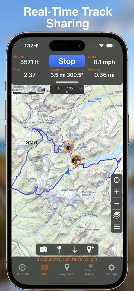
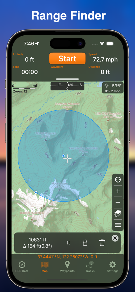
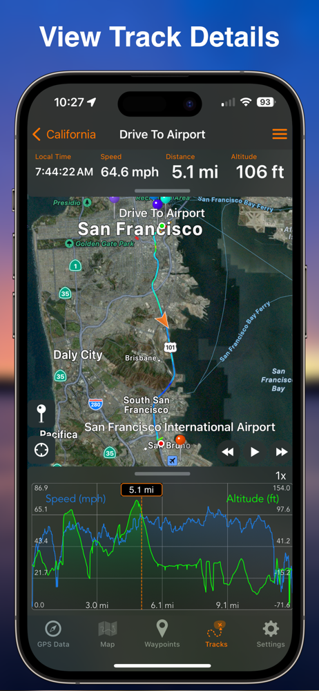
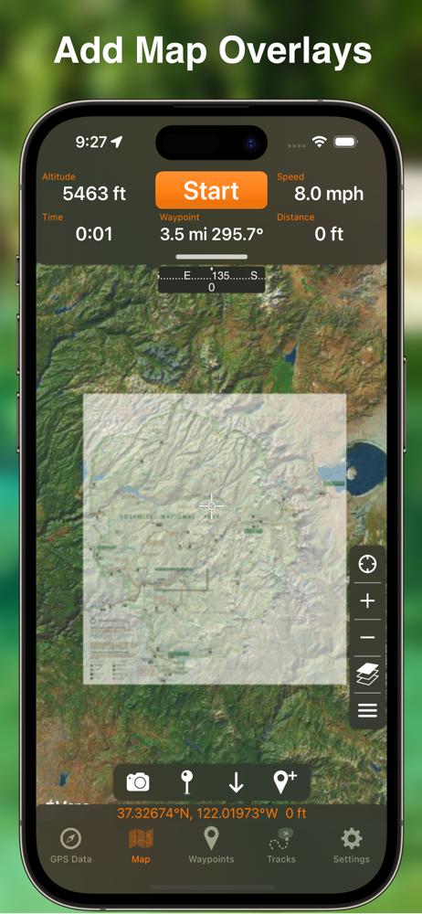
Screenshots


How Much Does GPS Tracks Make?
Platform Performance
Rating Distribution
Top Countries
Rankings
Reviews (3)▼
My new favorite place to walk is a park that has a lot of paths but the paths are not mapped out very well. The only way I knew to create an accurate map of the paths were to simply walk them, and have my phone track me while I walked. I did this using this app, and only on days where I had a lot of time, since once I picked a path I didn’t know how far it would go or how long I would walked. I simply kept doing this until I had walked all of the paths. There were so many trails that I didn’t walk them all on one day. I usually walked one trail a week. But the cool thing was that I was still able to create a map that showed all trails at once, so that from then on I was able to pick and choose what trails I wanted to take and even go from one trail to another during a walk. Other apps didn’t give me that freedom. They only showed one track at a time, and that made it impossible to connect the tracks together. Only with this app was I able to get the full picture so that I’d be able to pick which paths I wanted to take on any given day or view how long each path I picked would be on the days I didn’t have a lot of time.
As a long time Biological Field Technician I have nothing but good things to say about this app. I use it daily in the rugged and remote terrain in Hawaii. I have ditched my clunky Garmin handheld unit and can run tracks and take photo waypoints for my work all day long. I’m freed up from needing a PC to transfer data and I can now deliver info straight from the field via text msg or email. Loading external maps and data that have been emailed to me is a cinch. I use GPS Tracks to inspect conservation fences, track invasive species control and search for endangered plants as well as field navigation. I have even used it while flying to locate helicopter landing zones. The app doesn’t have a huge impact on my iPhone 8 battery life. So far it has performed very well when offline/No Service which is imperative in the Hawaiian backcountry. Although I am concerned about using it in a dense forest canopy, perhaps an accessory antenna may help. Love the mapping subscription and benefit highly from the ESRI contour map. Usability is easy to learn and I have gotten a number of coworkers to use the app on their phones.
I reviewed several GPS apps and bought too many useless ones before I found this one. Whatever your application, this is your app. On road or most especially off. It is feature rich and takes a little time to learn all it can do but it's worth every moment and penny. We use it for planning and tracking kayaking trips, mostly on local rivers and waterways. You can review, plan, map, and execute your track by land or water anywhere you can bring up on the map with this tool. Satellite or roadmap views. How far it is from bridge A to bridge B on that river? Go to Tracks tab and trace every bend and oxbow and know exact distance before you hit the water. Looks good? Name it and save it and this app will guide you down the track you planned. Ditto for hiking. Need a more detailed map? With a reasonable annual subscription a huge array of professional maps for various applications are available for purchase and can be download for permanent offline access. Driving, hiking, biking, navigating the waterways, this is your guide.
Version History (275)▼
Available In (115 Countries)▼
Supported Languages (8)▼
App Details▼
"One of the better GPS apps for sporting enthusiasts for the iPhone..." - Bryan Wolfe, AppAdvice.com Do you want to track your hiking, biking, walkin...
In-App Purchases (3)
| Name | Price | Type |
|---|---|---|
| Datum Add-On Pack | $2.99 | One-time |
| GPS Tracks Pro (Annual) | $29.99 | Yearly |
| GPS Tracks Premium (Annual) | $49.99 | Yearly |
Similar Apps


