
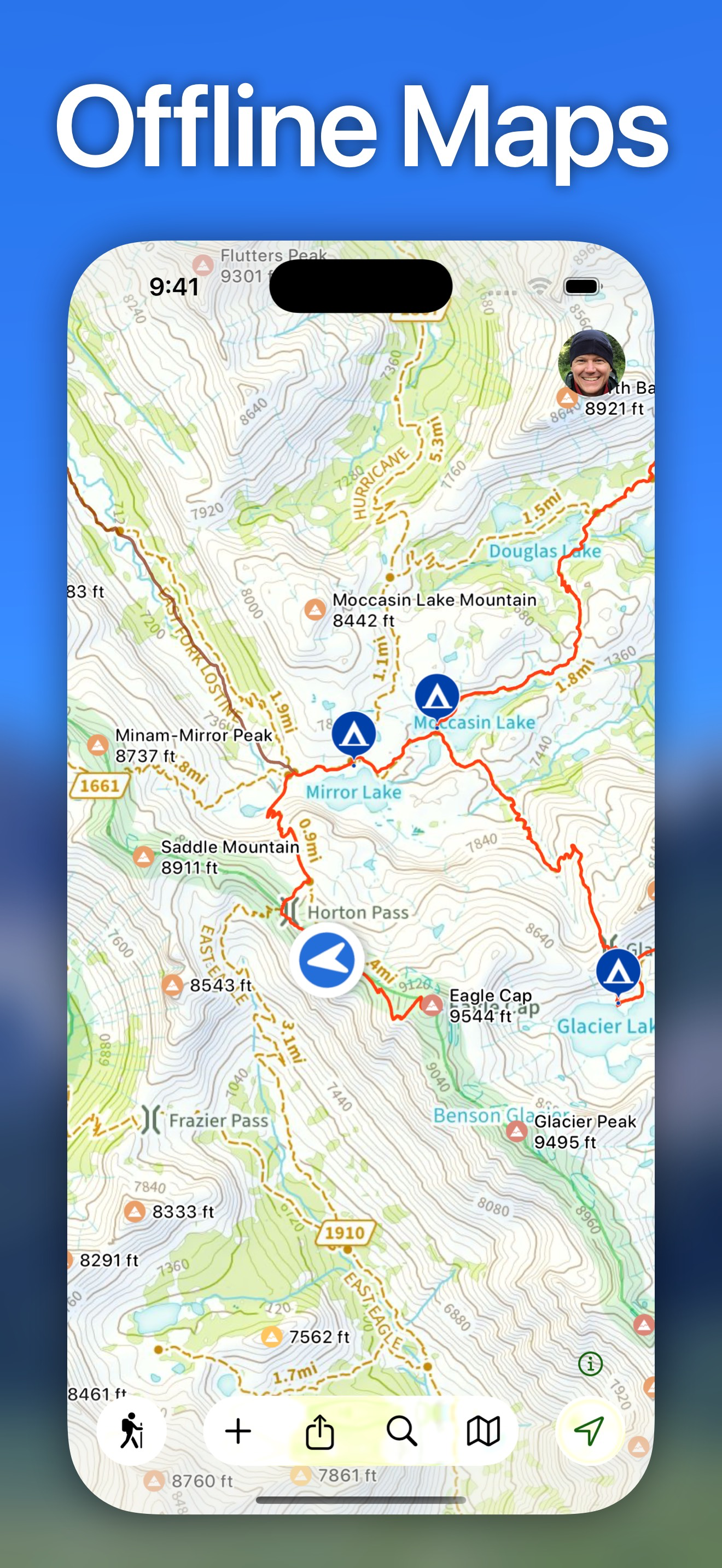
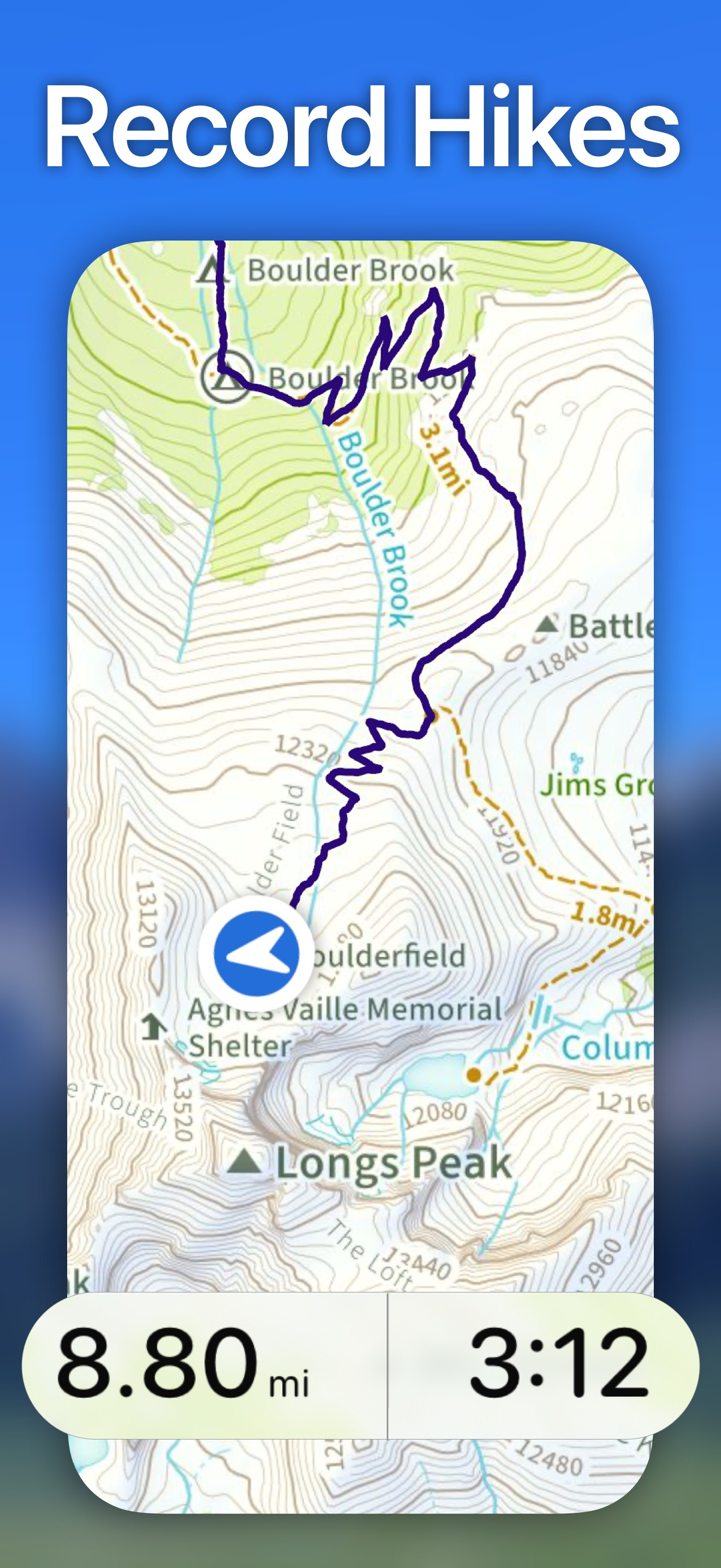
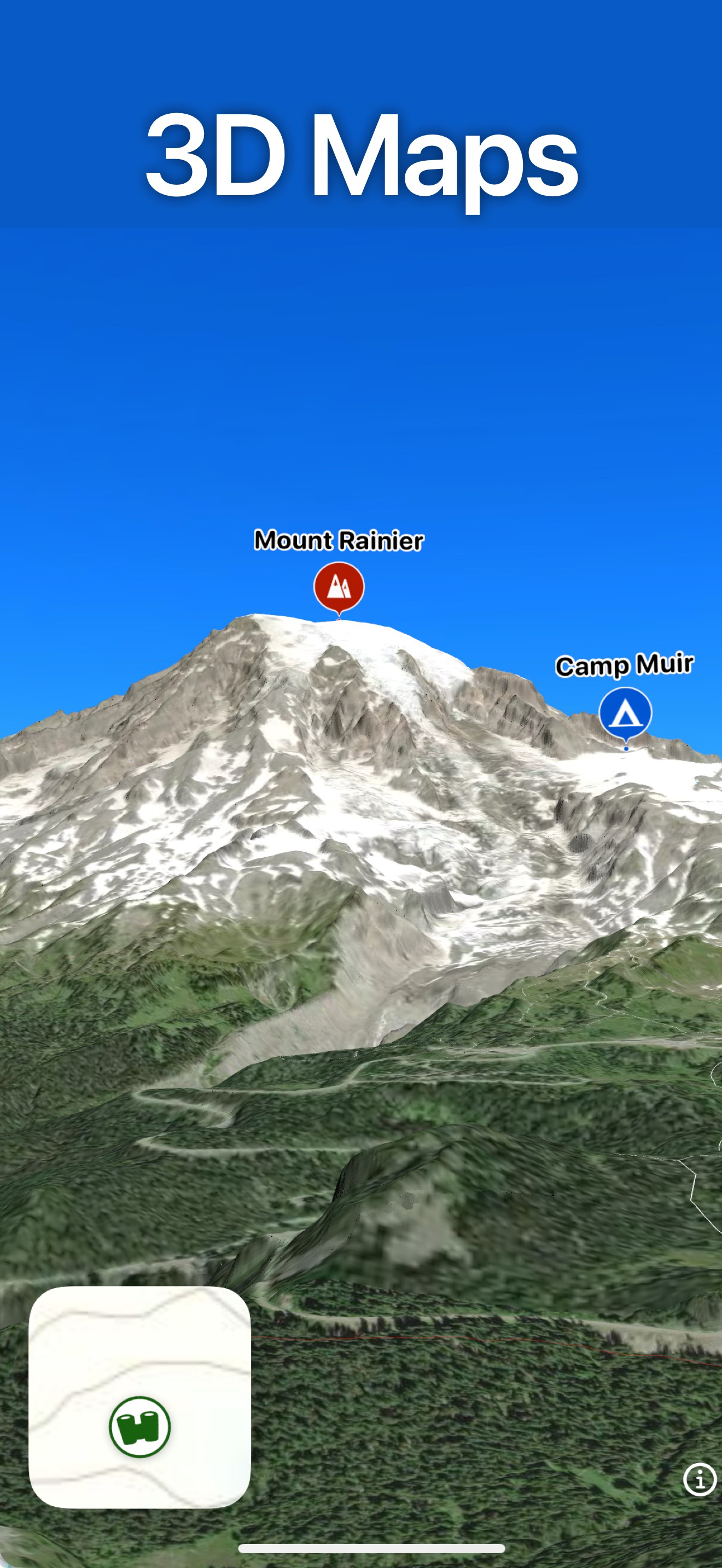
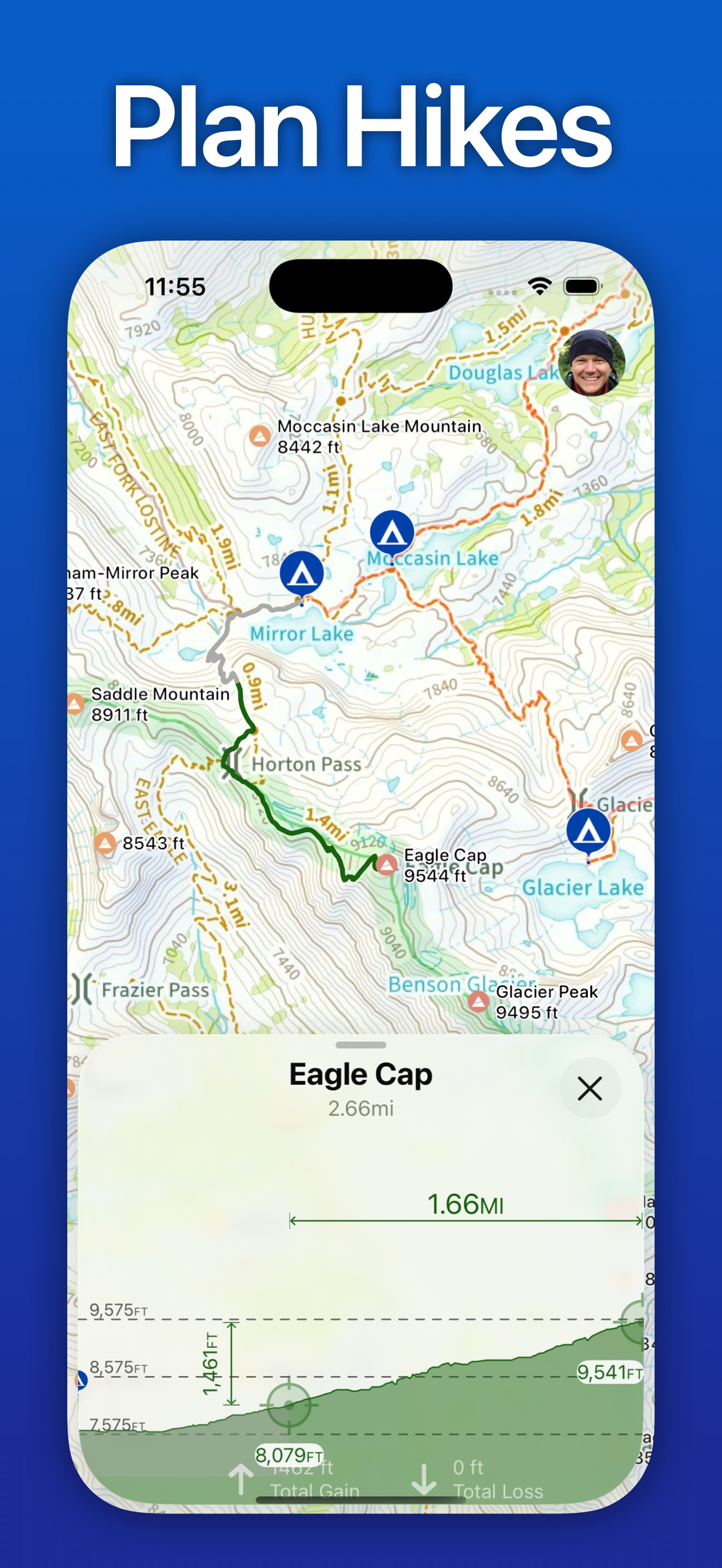
Screenshots


How Much Does Topo Maps+ Make?
Platform Performance
Rating Distribution
Top Countries
Rankings
Reviews (3)▼
This has been my go to app for several years. It has everything I need. Access to maps of all kinds, the ability to download for offline use, to track and trace your hike in all sorts of different ways. The user interface is very intuitive and the app has always been completely reliable. I use it primarily for hiking but also for running, biking, and even documenting sightseeing walks or drives when I travel. One of the things I like to do is to upload my hikes or travels to my computer which is easy to do, plus you can go the other direction and upload gpx or kml tracks into the app. It also gives you the opportunity for land ownership maps if you want to subscribe to it which I have found very useful. I love it! I am writing this review now because recently I had troubles with uploading some files to my computer and I sent them an email about it, figuring I would have to wait weeks or maybe longer. Instead I went out for a bike ride and when I got back, I had an email from them diagnosing the problem, fixing it, and even giving me a workaround for old files! That's the best customer service I have seen in years! So you can't go wrong with this app.
I’ve been using this app for five years and developed trail maps for friends and family with it. It continuously impresses me and everybody I share it! While the developer always recommends printing out paper maps (with the app) when you go into the wilderness, this app will not fail you. Every year there are new features that make your planning easier and you’re hiking more enjoyable. I am especially enjoying marking waypoints where I find wild mushrooms and wild flowers so I can easily find them each season. I’ve also imported GPX property lines and others trails into topo maps plus. The iPad version is fantastic for planning routes and reviewing a trip with others, too. Most of my friends choose to pay for the subscription (one time ) and download the maps for the place we go each year. Others use the free version to keep on the trails I’ve mapped and helped import into the free version. I and a few of my friends and family subscribe to the pro version because of all the help we’ve received from the developer in mapping our area and the gratitude we feel for such an amazing tool. I have used the app hiking in more than 9 US states. It frequently helps me find local places to hike in new areas. Download it and the more you use it, the more you will see what it has to help you enjoy in the wilderness or your local park.
I downloaded this for a trip to the Grand Tetons and Yellowstone. I went ahead and paid for the detailed maps of those parks as separate purchases. Once I got to the area, I couldn’t tell if I was using those maps. I finally realized that I wasn’t. I kept trying to download them, but iffy WiFi and cell signal in the park made it fail. I finally sent a note to support and got a reply from the founder of this app. I really can’t fault his follow up. He talked me through the maps icon showing the map you are using having a green border. The downloads have to continue until they say Open. At home this is no big deal, but on low bandwidth that download can sit in full green for a while before showing Open. I kept closing it too soon. Anyway, resolution is very good on those purchased maps and if you download them ahead of time, it is easy to use. With family sharing, others in the family can also download them. A friend that came with us got the subscription. This meant she had to download each map section. Again, better to do that before you leave stable WiFi. Only after I got home did I try my iPad. Looks great and we could have used that for planning the next days hikes over dinner. Without GPS, wifi only iPad won’t show location or path. But it is a nice big, high quality map for planning. So the interface could be easier, but it works as advertised and the founder Mr. Johnson has my thanks for reaching out to help, personally.
Version History (216)▼
Available In (115 Countries)▼
Supported Languages (7)▼
App Details▼
Designed and tested on real dirt, Topo Maps+ is packed with the maps & tools to plan and execute your backcountry adventure. ‣‣ MAPS FOR EVERY ACTIVI...
In-App Purchases (10)
| Name | Price | Type |
|---|---|---|
| 3 Month Map Pass | $11.99 | One-time |
| Topo Maps+ Essentials 3 Months | $14.99 | Quarterly |
| 6 Month Map Pass | $14.99 | One-time |
| 12 Month Map Pass | $19.99 | One-time |
| Topo Maps+ Essentials (Annual) | $29.99 | Yearly |
| Topo Maps+ Pro: 3 Months | $29.99 | Quarterly |
| 3 Months PRO | $29.99 | One-time |
| Topo Maps+ Pro (Annual) | $59.99 | Yearly |
| 12 Months PRO | $59.99 | One-time |
| Topo Maps+ Elite (Annual) | $79.99 | Yearly |
Similar Apps


