App Profile: Topographic Maps & Trails

Android / Games / Puzzles
Topographic Maps & Trails
Installs:
Rating:
4.57
Total Reviews:
2.74k
Top Countries:
US, AU, GB
< $5k
/mo
< 5k
/mo
Reviews: What People Think About Topographic Maps & Trails
vbmike
Rating: 5/5
Honestly I wish every app had the level of support behind it that this one does. I wanted to buy it for my hikes in areas with no data service, and liked what this one had to offer. I still had some questions though before purchasing, so I emailed developer. Within a few hours, I had a reply answering my questions. I bought the app and I’m extremely pleased with how it operates. But I’m even more impressed with the support. Since then, I’ve emailed with more questions and get a reply back immediately. Thank you for setting the bar (actually going way beyond) of what should be expected from app developers. I will recommend this app and your other apps to everyone I know.
prtnsrv
Rating: 5/5
I’ve been using USGS 7.5’ maps for the past two decades both for work and pleasure. This app has integrated the same data into a user friendly mobile database. A similar Topo app requires you to pay for the same detail that is free here as well as on the USGS website. Thank you for the hard work and detail you’ve put into this app.
I haven’t had the chance to use this offline yet but I’ll be testing it out soon.
Bob6900
Rating: 5/5
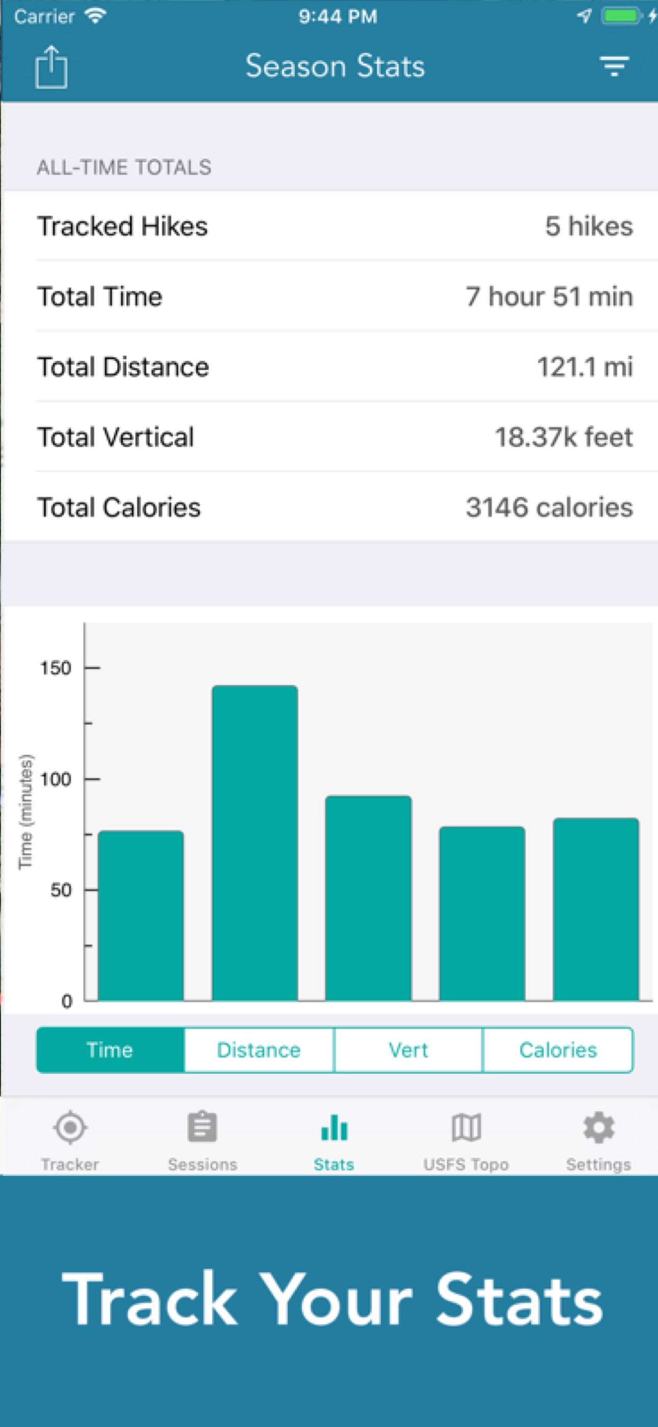
I use this app on my daily hikes and walks and I like keeping a visual record of my outings. My question is what the colors represent in the track graphics. I hike some pretty steep hills and while at first I thought the red-green color variation represented incline, it doesn’t seem to correlate, so now I’m thinking it represents horizontal speed.
It would be nice to know. Otherwise this is the tracker that I’ve been waiting for. Thanks!
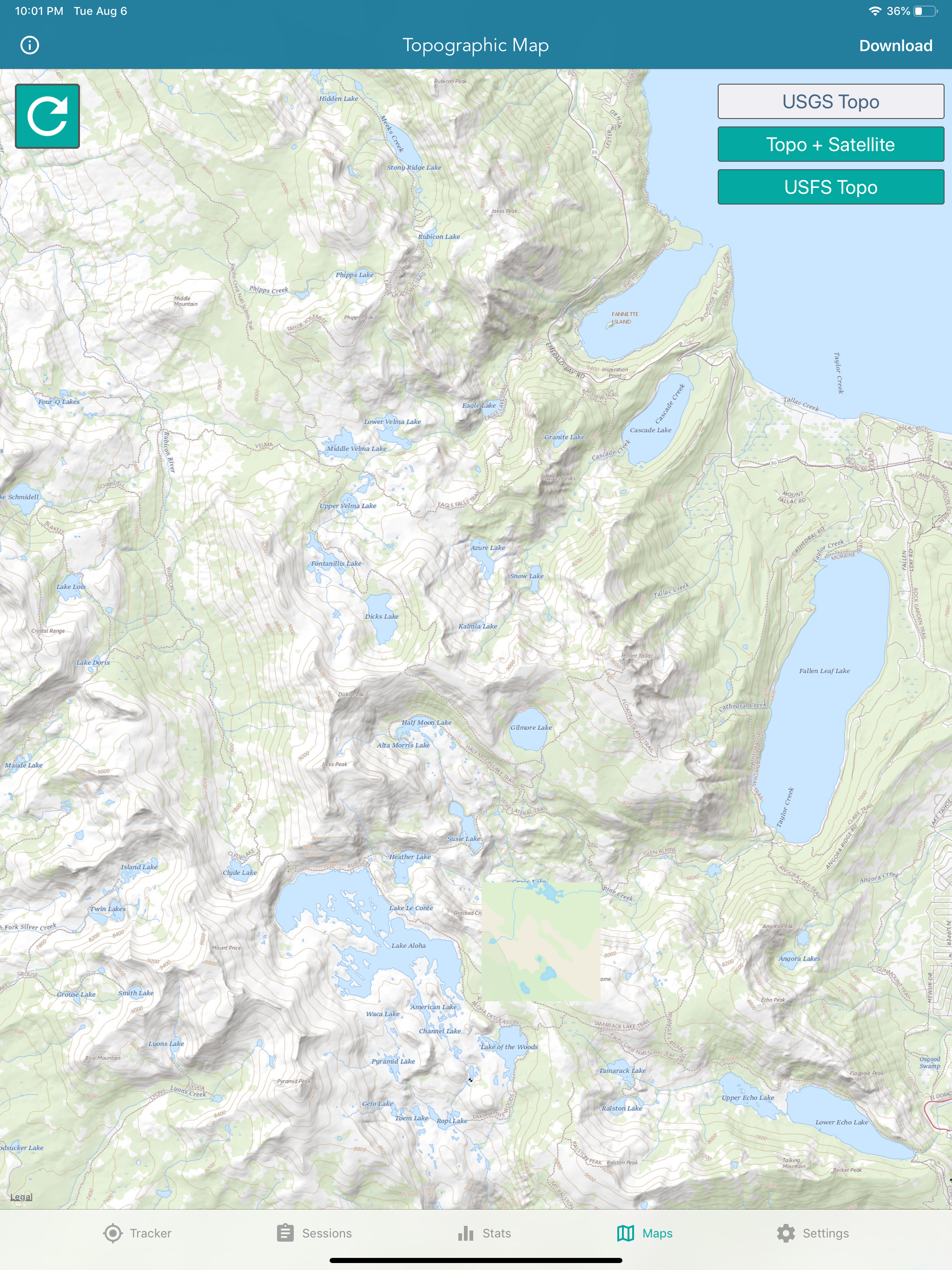
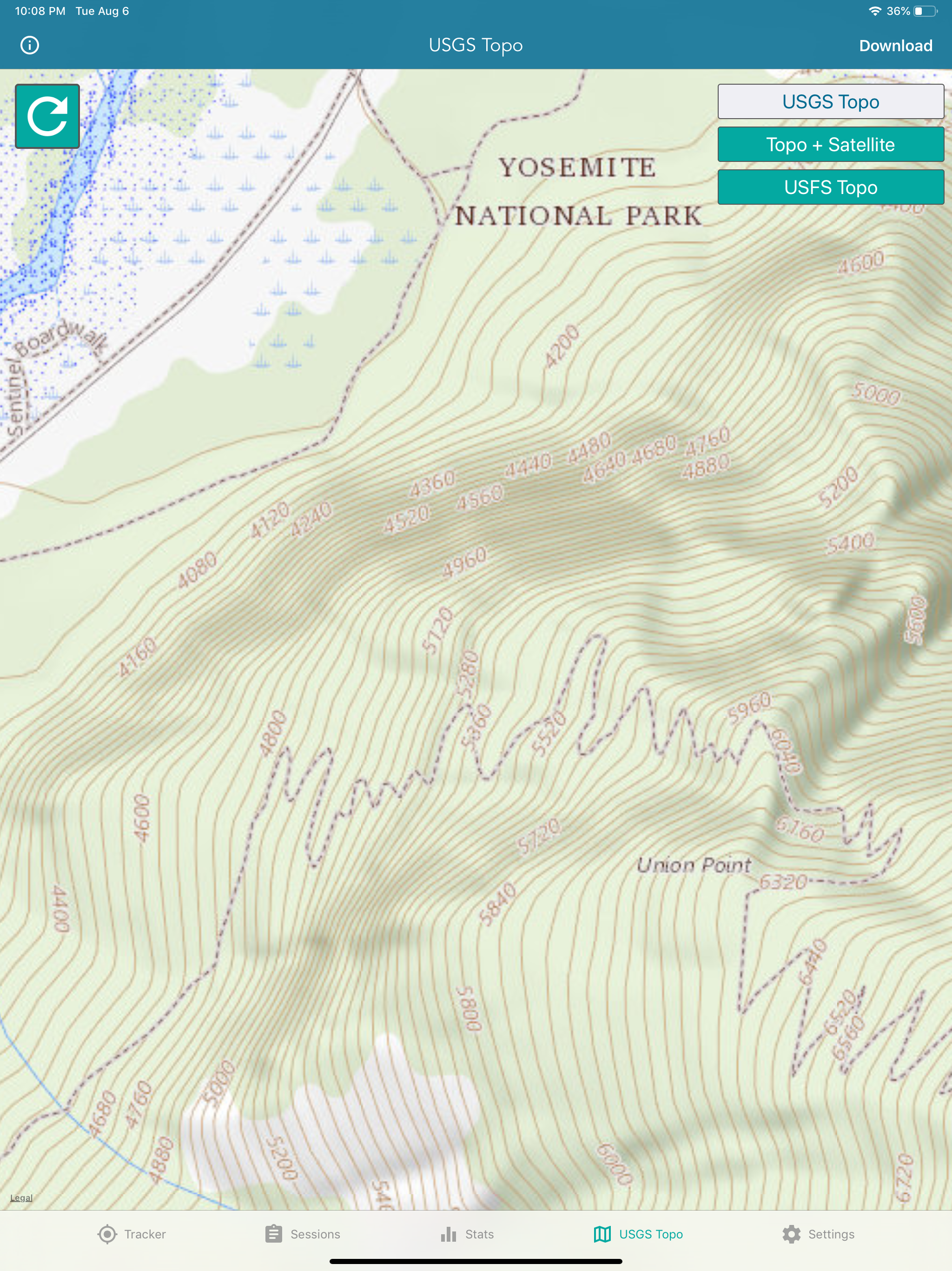
About Topographic Maps & Trails
DOWNLOAD ALL MAPS FOR OFFLINE USE
MAIN FEATURES INCLUDE:
- USGS Topographic Maps
- Satellite + Topo Maps
- Hiking Tracker
USGS TOPO MAP
USGS Topo is a tile cache base map service that combines the most current data in The National Map (TNM), and other public-domain data, into a multi-scale topographic reference map.
TOPO + SATELLITE
USGS Imagery Topo is a tile cache base map of orthoimagery in The National Map and US Topo vector data. Orthoimagery data are typically high resolution images that combine the visual attributes of an aerial photograph with the spatial accuracy and reliability of a planimetric map.
Data themes included are Boundaries, Geographic Names, Transportation, Contours, Hydrography, Land Cover, Shaded Relief, Trails, etc.
HIKING TRACKER
Now you can track all of your hiking stats!
- Track total distance, vertical, time
- Track calories burned
- Keep track of yearly stats
- Color coded tracks by elevation
- Backup your hike data to iCloud
- iOS 14 home screen widget
Have questions?
Feel free to contact me at [email protected]
File size: 24513536
Launched countries: USAUCACNFRDEGBITJPKRRUDZAOARATAZBBBYBEBMBRBGCLCOCRHRCZDKDOECEGSVFIGHGRGTHKHUINIDIEILKZKEKWLBLTLUMOMGMYMXNLNZNGNOOMPKPAPEPHPLPTQAROSASGSKSIZAESLKSECHTWTHTNTRUAAEUYUZVEVNBOKHEELVNIPYMZYEBHCYMT
Minimum OS version: 15.0
Release Date: 1541194332000
Published by LW Brands, LLC
Website url:
Publisher country: US