
Check the acquisition promise
Read the store headline, screenshots and description. What problem is the app promising to solve?
Study the storefront ↗
Mappendix Limited · iOS
Explore the ad evidence, study the storefront, and build your next acquisition hypothesis.
01 / Creative research
Read the store headline, screenshots and description. What problem is the app promising to solve?
Study the storefront ↗Explore apps with direct store-link matches. Compare their hooks and formats without assuming the same approach works here.
Browse observed advertisers ↗Store rankings and revenue estimates describe market context. They do not establish ad spend, conversions or ROAS.
Review the market context ↗02 / Storefront & product
Study the product story and store experience behind the acquisition funnel.



03 / Market context
Keep revenue, downloads and store rankings separate from advertising performance.
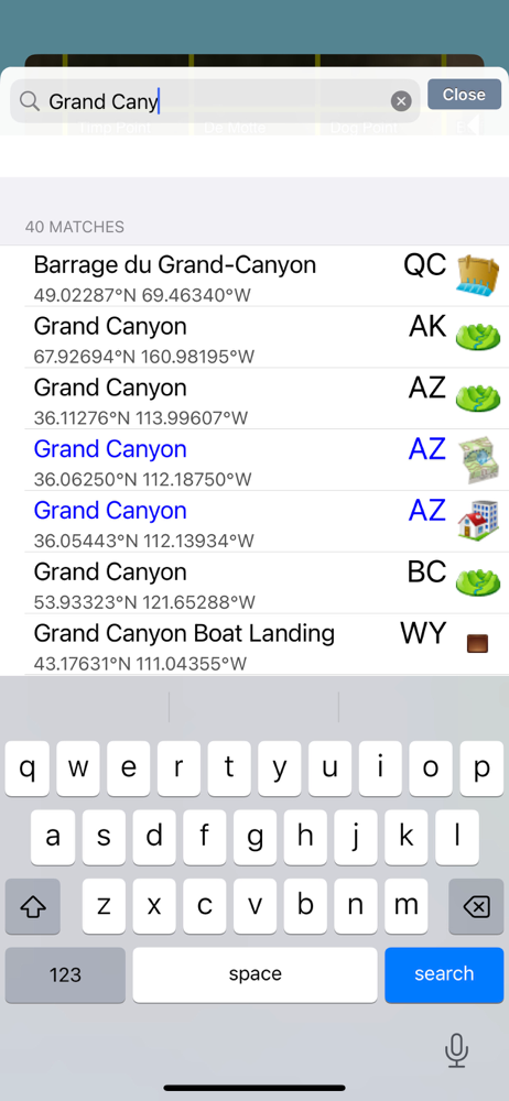
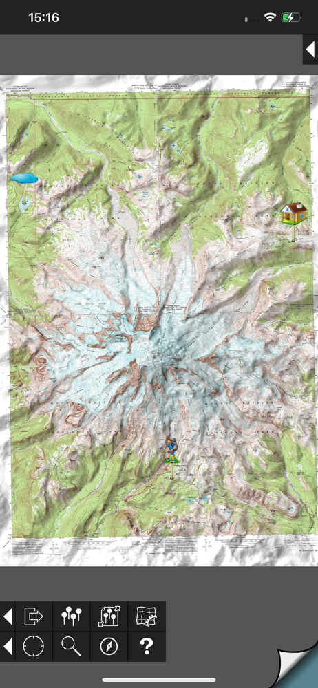
I have used this app for years, iPhone 4 days. I wish the developer would update the maps but even as it is it is far more useful than most. It seems like it’s been abandoned which is sad. But it’s still worth it, You pay ONCE and have access to download Topo maps of the entire U.S. for as long as you want. All on your phone so no data connection needed. All is not roses though. - alignment is seriously bad in some places. Laughably so. Central Washington state has maps so far out of alignment that adjoing maps look like cards tossed randomly on a table. I have paper USGS Topo maps of the exact same sections and those align perfectly. My National Geographic Topo maps of the same area align perfectly as does my Gaia GPS app. Not sure why these are so badly out of whack. Seems to happen somewhere in areas of various different states i have downloaded maps for -there needs to be a GPS tracking feature. So the app lays down a trail that follows your progress and the tracks can be saved and recalled. The app is really lacking in usefulness without that feature. I am still having to use Topo! Which has this feature so I can save tracks of my adventures. I would love to not have to use Topo! anymore though because it was built for windows 95/XP and that ship has long since sailed. -this isn’t 2000 anymore so the 36 map or whatever limitation that exists when downloading hi-res versions of maps should be removed. These maps are small and downloading even an entire state would be very manageable on todays fast WiFi connections. - need to be able to import GPX files -
I love this app. The map resolution and stitching are excellent. The maps are stored on your phone, so it works way out of data range. Each map is about the size of a standard photo, so you can download hundreds if you want. You see your position on the quad map, and you can drop waypoint pins at your current location or at other points without going there first. The only thing it doesn't do that my old Garmin does, is show your track. The compass link function lets you aim the whole map at a distant object to identify it. You can also switch the map to Google aerial photo of the same area, if you are in data range. I like the old '83 topo quad maps. You see old trails that aren't on newer maps. You wouldn't use this app for driving around town, because a lot of newer roads will be missing, but rarely a problem out in the woods. This app has almost completely replaced my old GPS. The tutorial is nice and clear.
I have owned this app since its launch and can honestly say it is my favorite app period. I am an avid backpacker and hiker and this app has allowed me to find some of the most amazing places in the wild. Maps must be downloaded while you an internet connection, but the gps usually works while out of service so you can locate your position on the topo. I love the ability to link maps together and zoom way in for detail. The map quality is identical to paper topos. I used this app while hiking the John Muir trail and it was great for checking my location and finding off trail lakes and campsites. The search feature works really well so you can find the map you need quickly, download and head out for your adventure. Can't believe this app isn't more popular as it is awesome.
* View over 70,000 Natural Resources Canada 1:50,000 and USGS 1:24,000 topographical maps on your iPhone or iPod touch. * Ideal for hiking and other...


