
Screenshots


How Much Does UK Map Make?
Platform Performance
Rating Distribution
Top Countries
Reviews (3)▼
I recently cycled from Land's End to John O' Groats. I took along paper maps, but this app was indispensable on the few occasions where I was doubtful about my location or just wanted to know how far up a hill I had come. It was especially useful in larger towns where it's easy to make navigation errors. Being able to download maps in advance of the trip, and turn off my phone's data connection (with the GPS still active) saved me huge data roaming charges, and gave me instant access to the maps when I needed them. I didn't have the app open all the time, but when I needed it, it worked, and it was fast. I had another app with me for "offline" GPS use, and it also worked well, but this was my go-to option. It's a pity the 1:50,000 scale maps Ordnance Survey maps aren't available (due to licensing differences) as they would provide interesting detail, but this app is nonetheless great value.
Reasonable program but has it's limits. My main use would be for offline mapping with no internet support so I wanted a program with nice map/waypoint downloading capabilities. Map downloads limited to the newer UK Ordinance Survey maps. These maps do not have as much detail as do the older maps, particularly in regard to old megalithic sites (the main reason I bought the program). Downloading map areas works quite well. However, the 25K and 10K scale maps don't seem to be a lot different in the information they contain, just more pixels. No option to input user defined waypoints. Pricey for what you get.
I like the U.S. but travel to the U.K. from time to time and have always liked the maps there. Navigation in England is much more a challenge than in the midwest U.S. Anyway, this is one of the first apps I bought on my iPad 3G and it has been excellent! There were some tech issues leading up to the UK iPad release but the developer was very responsive and got them fixed. What I adore about this app is that there is no delay while maps download. The built-in Maps on the iPad is really good, but it does rely on an active data link for the images. UK Maps has them all on the local machine, and you can download and store additional street-level detail for selected areas. I am working out a five week trip for my daughter this summer and this mapping is very useful for that. I would also note that last year I was over and had a Garmin GPS unit with me. This worked very well in getting me right to my next destination but at the cost of losing perspective about what was around me as I went, as I hadn't pored over maps picking the routes ahead of time. This UK Maps app would restore that perspective, it's a pity the iPad wasn't out last year! Although not by this developer, the Mini A-Z Map of London is also a good implementation of a machine-resident map. Like the UK Maps, it will show you your position using the 3G's GPS when it can see the satellites.
Version History (33)▼
Available In (115 Countries)▼
Supported Languages (1)▼
App Details▼
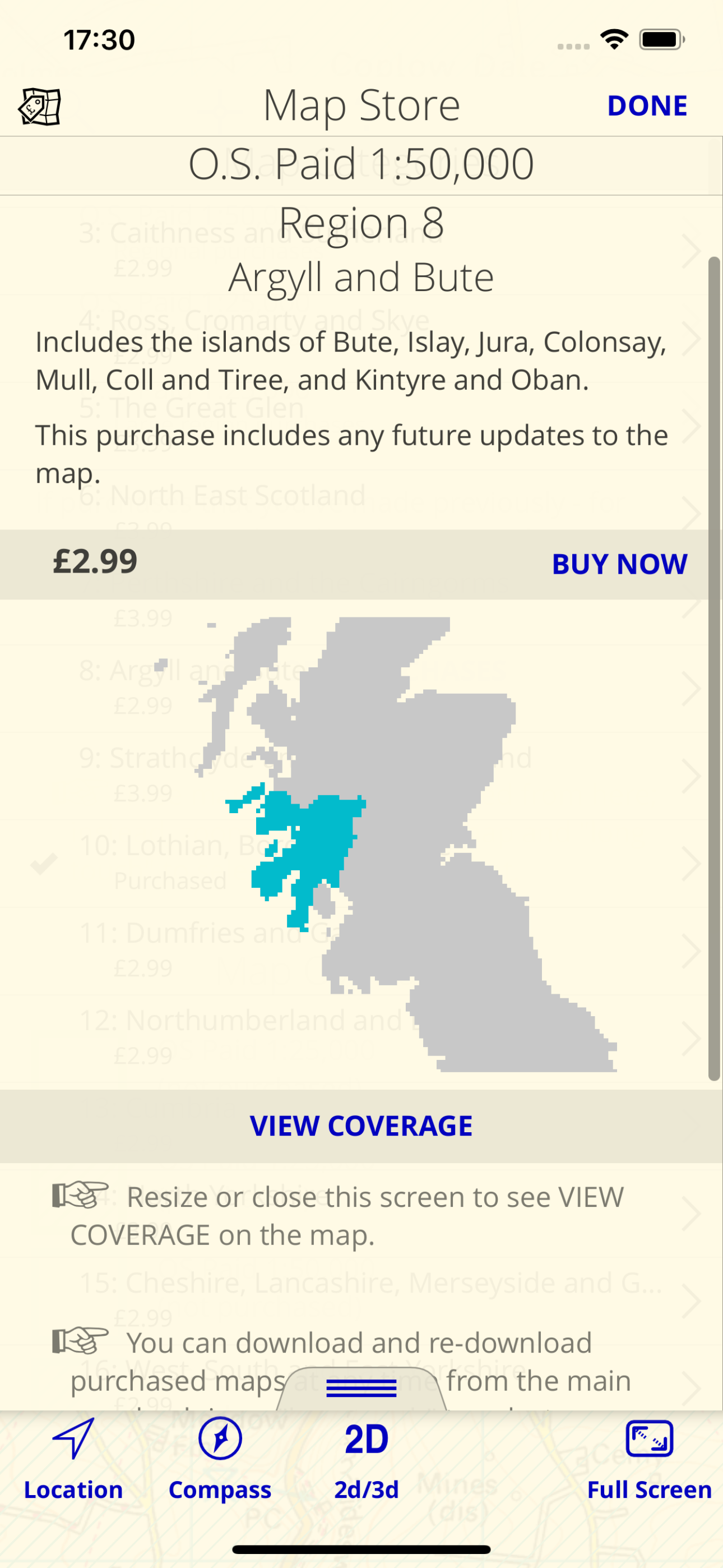
* Unlimited free map downloads based on Ordnance Survey® OpenData, at 1:25,000 and 1:10,000 scales, and now also paid map downloads at 1:50,000, 1:25,...
In-App Purchases (10)
| Name | Price | Type |
|---|---|---|
| OS 1:50,000 maps region 31 | $1.49 | One-time |
| Exeter OS City Map | $2.49 | One-time |
| OS 1:50,000 maps region 13 | $3.89 | One-time |
| OS 1:50,000 maps region 22 | $4.19 | One-time |
| OS 1:50,000 maps region 28 | $4.49 | One-time |
| OS 1:50,000 maps region 10 | $4.59 | One-time |
| OS 1:50,000 maps region 12 | $4.59 | One-time |
| OS 1:50,000 maps region 4 | $4.69 | One-time |
| OS 1:50,000 maps region 14 | $5.19 | One-time |
| OS 1:50,000 maps region 9 | $5.49 | One-time |


