Screenshots


How Much Does Air Navigation - VFR & IFR Make?
Platform Performance
Rating Distribution
Top Countries
Reviews (3)▼
I love the clear communication. It's like having an assistant in your pocket on the go.
When downloading, I didn't think the app would have such advanced technology, but it really has all it takes to fly an aircraft!
Assume your customer may know nothing and make it easy for them to get started. When you assume everyone has a basic knowledge, you write off everyone who is just getting started. I see your software and I get excited. I think this could work for me. To save me and others time and dramatically increase your sales you need to work with new student pilots and pilots like me that last flew 40 years ago and just getting back in. Make a video for us that gets us started and we’ll take off. Neglect this and we will pay more for someone else who explains their software in ways we can understand! If you want be successful, don’t neglect making a how to manual for every option you provide! Good luck! Make a ton of money providing software that has an easy learning curve! Neglect this and you limit your customer base to those who already know basically what you are promoting. When I find something good that I like and I can explain it to others. That makes me and others, your best salesmen. Fritz
Version History (55)▼
Available In (115 Countries)▼
Supported Languages (1)▼
App Details▼
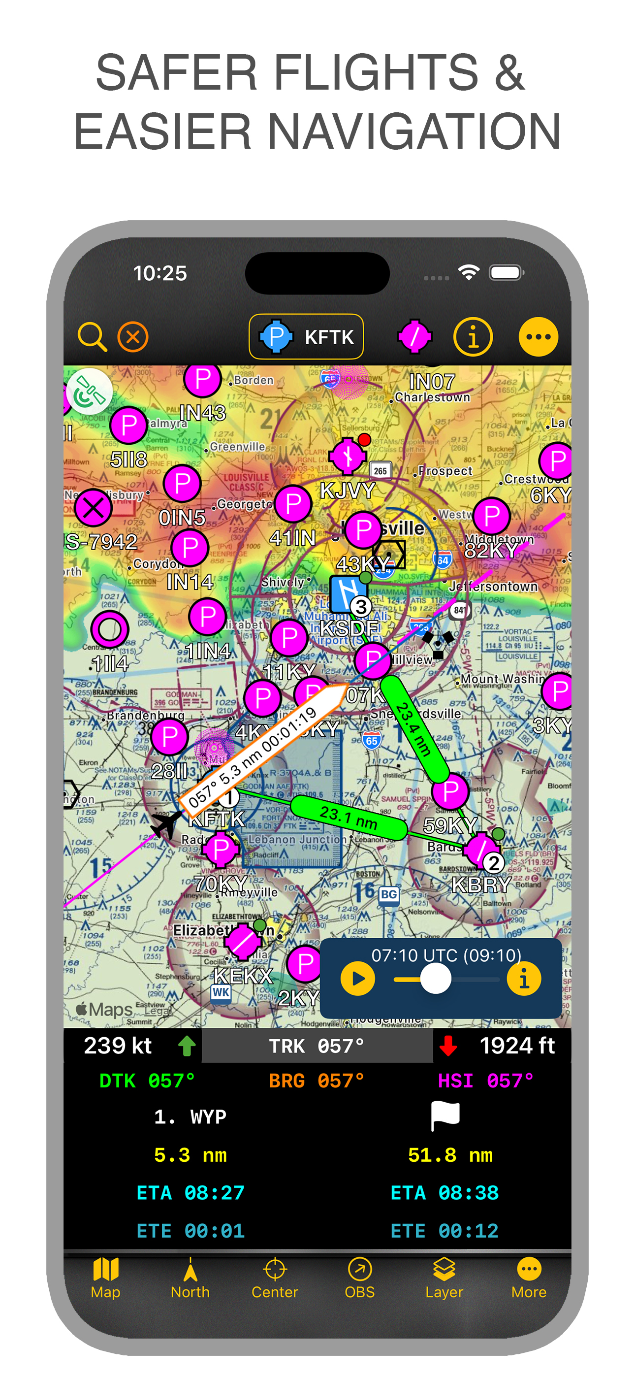
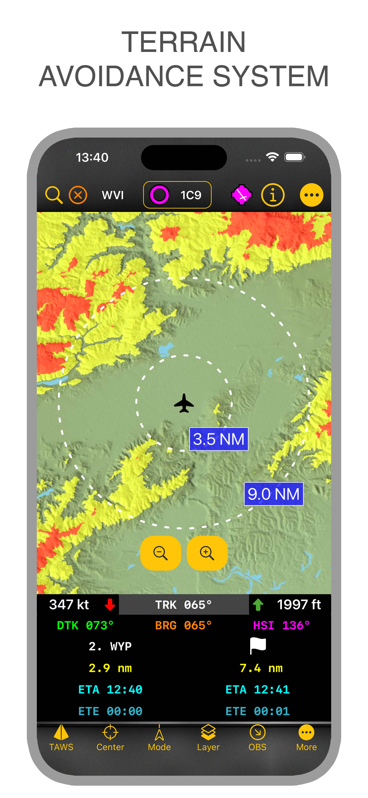
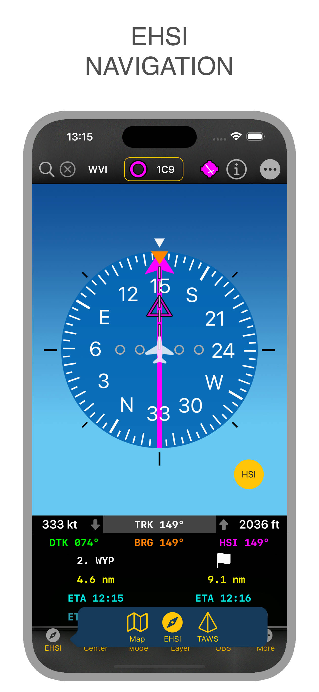
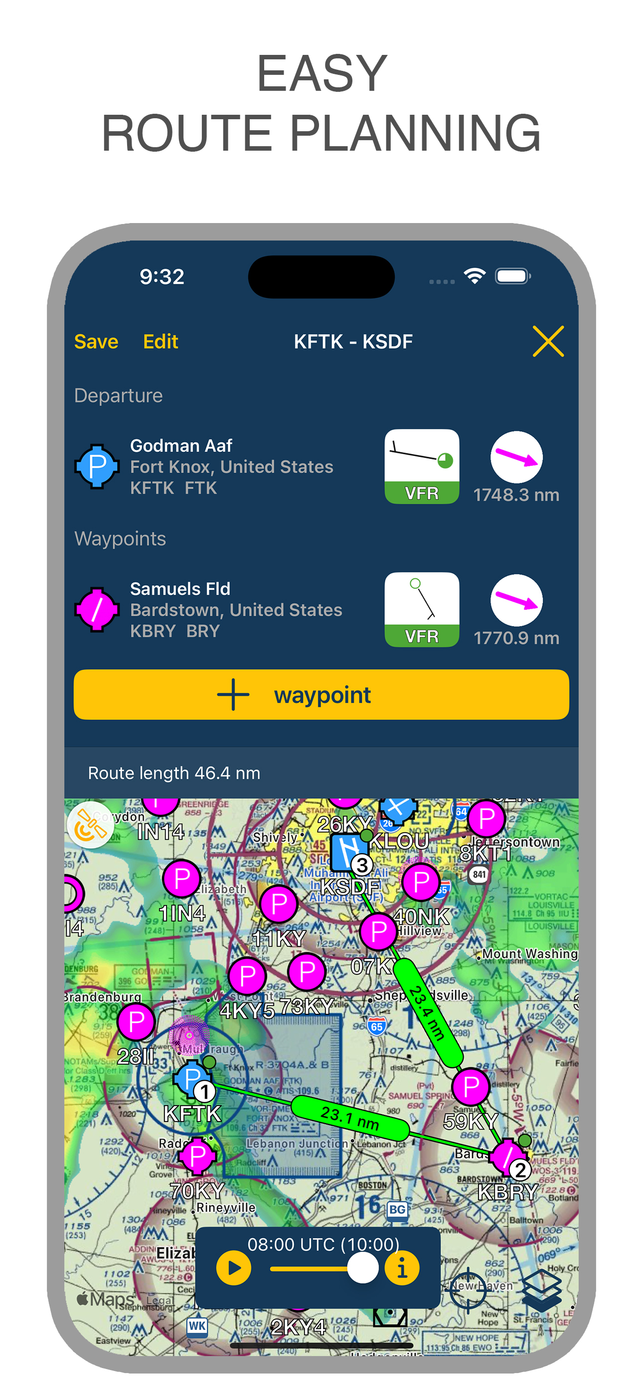
Air Navigation - VFR & IFR is the ultimate flight planning and navigation app for pilots. Plan VFR or IFR flights with worldwide charts, real-time wea...
In-App Purchases (4)
| Name | Price | Type |
|---|---|---|
| Air Navigation Basic 1 Month | $2.99 | Monthly |
| Air Navigation Pro 1 Month | $3.99 | Monthly |
| Air Navigation Basic 6 Months | $14.99 | Semi-Annual |
| Air Navigation Pro 6 Months | $19.99 | Semi-Annual |
Similar Apps