Screenshots


How Much Does PIX4Dcatch: 3D scanner Make?
Platform Performance
Rating Distribution
Top Countries
Reviews (3)▼
Game changer !!!! Must use device!
Great multi function product but outputs contradict. When exporting a scan, photo geo tags are in gps (lat/lon). When exporting GCP’s, coordinates are in SPC (northing/easting). Works great when staying contained within PIX4D environment. However limits using in 3rd party software (ie Faro 3D or Leica Map 360). Having the GCP’s export in GPS coordinates as well would be beneficial to be able to use the viDoc to pickup extra points on a scene and just add them to an existing project like a total station or gnss receiver. * Using RTK and referring to csv outputs
Long time pix4d user for drone based 3D modeling. PIX4DCatch is the perfect ground based photo capture tool. Depth images from the iPhone 12 Pro make really crisp models. Always improving software makes capture and quality estimation in the field a breeze! Well done.
Version History (95)▼
Available In (115 Countries)▼
Supported Languages (8)▼
App Details▼
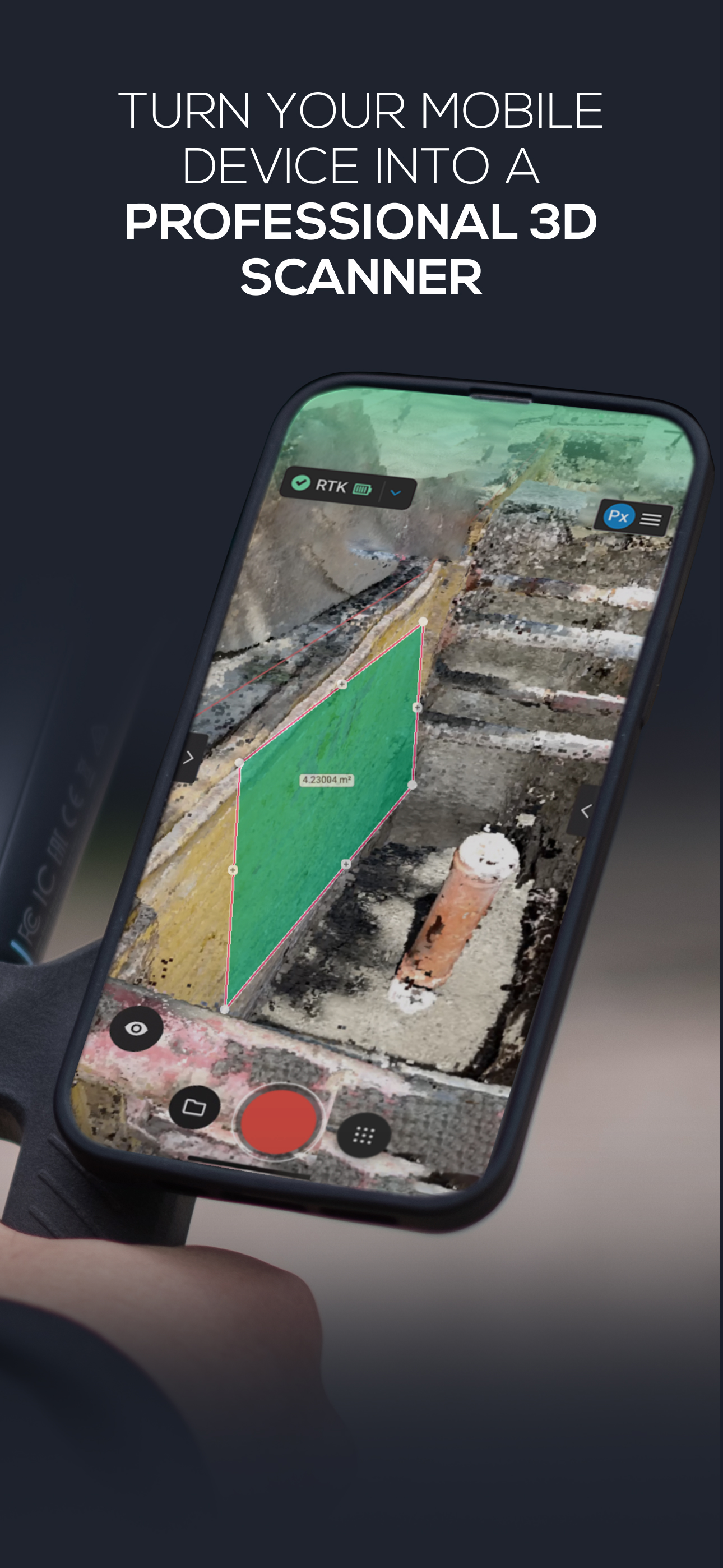
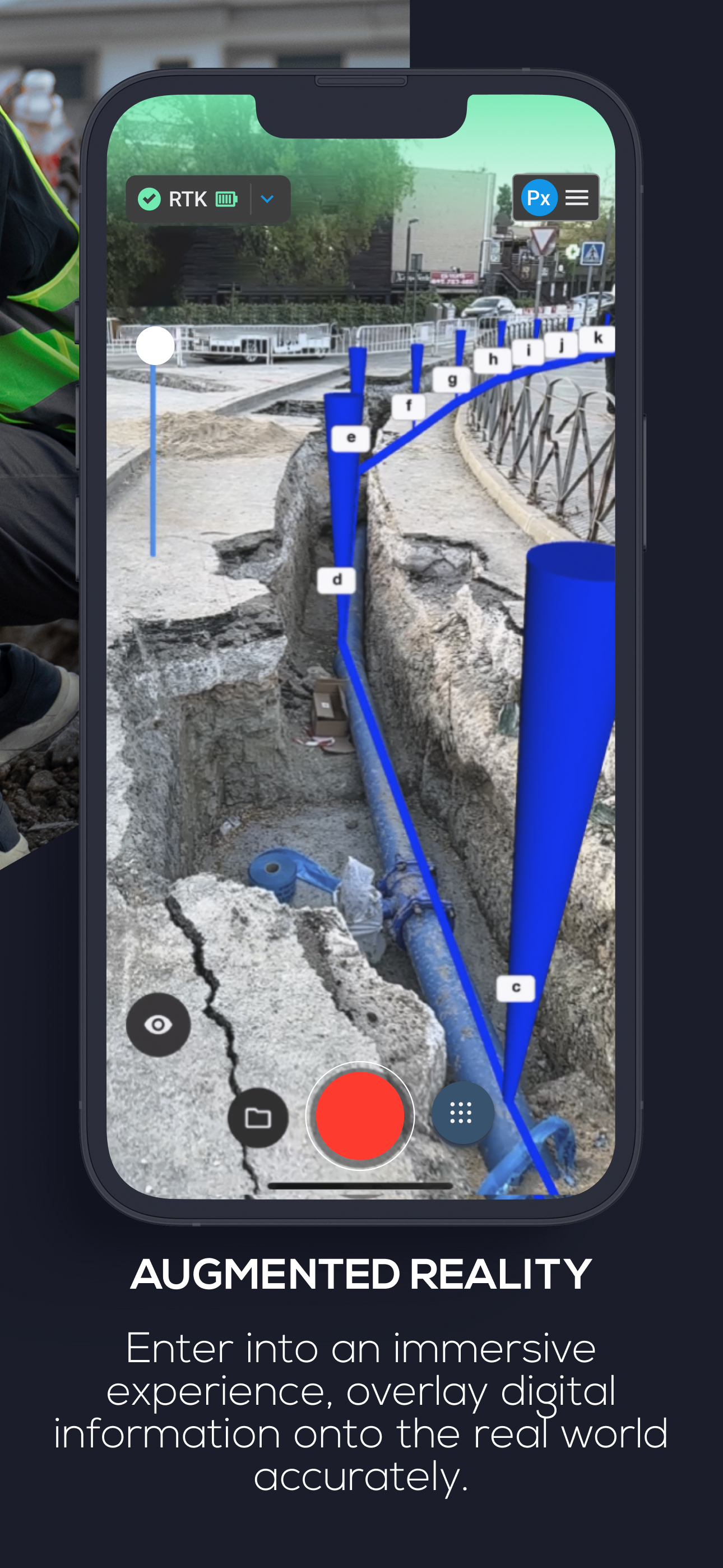
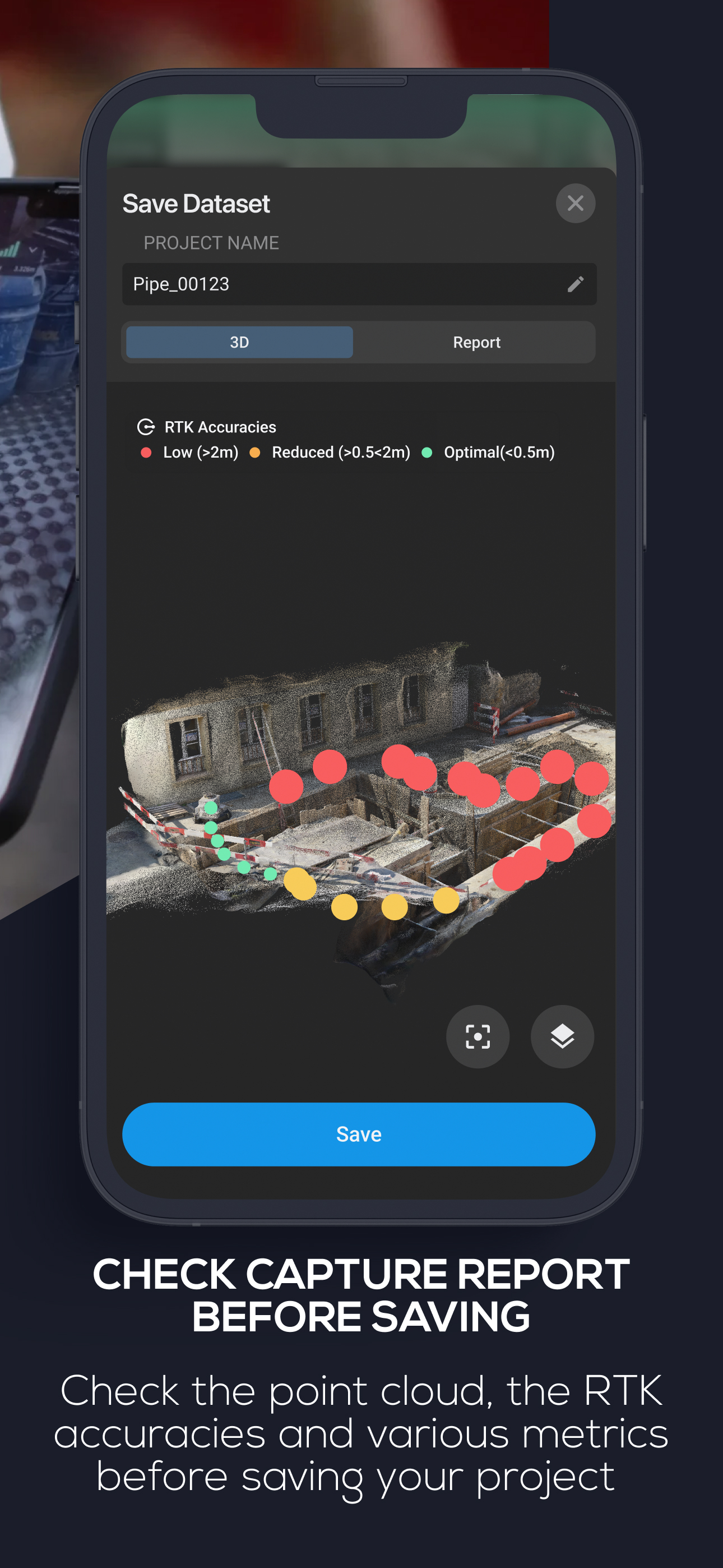
DIGITIZE REALITY Transform your mobile device into a powerful 3D scanner. Simply point and capture images and LiDAR data to create accurate 3D models...
In-App Purchases (1)
| Name | Price | Type |
|---|---|---|
| PIX4Dcatch Professional (Monthly) | $159.00 | Monthly |
Similar Apps