Check the acquisition promise
Read the store headline, screenshots and description. What problem is the app promising to solve?
Study the storefront ↗
Winegard · iOS
Explore the ad evidence, study the storefront, and build your next acquisition hypothesis.
01 / Creative research
Read the store headline, screenshots and description. What problem is the app promising to solve?
Study the storefront ↗Explore apps with direct store-link matches. Compare their hooks and formats without assuming the same approach works here.
Browse observed advertisers ↗Store rankings and revenue estimates describe market context. They do not establish ad spend, conversions or ROAS.
Review the market context ↗02 / Storefront & product
Study the product story and store experience behind the acquisition funnel.





03 / Market context
Keep revenue, downloads and store rankings separate from advertising performance.
One of the best uses of technology is uninformed my iDevice’s camera for precise aiming; kudos for that great use of the tech at hand (literally). Some information that is presented is inaccurate for my media markets (Providence and Boston), and the usefulness is reduced because you don’t tell me what the channels’ transmitting frequencies are. For instance, where I am, there are three VHF frequencies used: 2, 7 and 12 (for 36, 12 and 64, respectively). Why not include the frequency of transmission, and sell the best antenna for those frequencies? Lastly, you have misidentified at least two things: 1) WLWC’s transmitter location moved years ago, 2) WHDH is identified as the NBC affiliate, but it has not been the NBC affiliate since 1 Jan 2017. I’d be embarrassed at these inaccuracies.
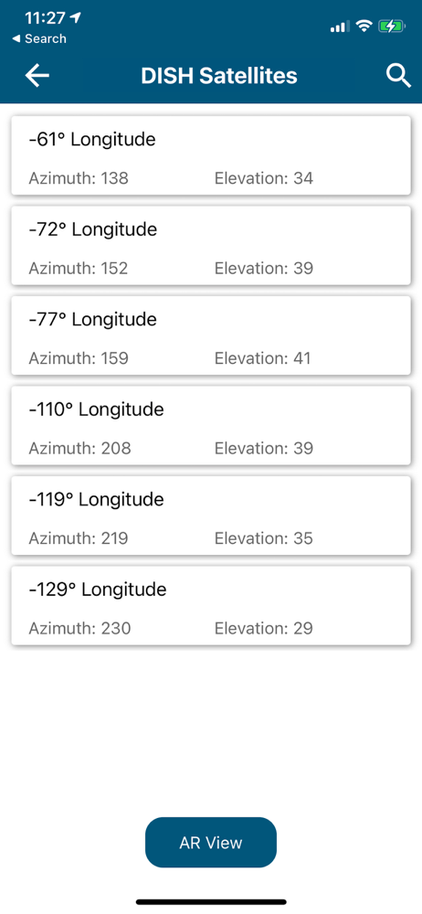
Try to find satellites show up for a couple of seconds and then disappear. Go off of location and come back satellites appear then disappear again. I can never view the satellites long enough to try to see if the satellites are in the clear. When I first downloaded the the azimuth was way off from published data and now with the satellites disappearing this app has never been useful. Based on recommendations, I did calibrate sensors, but that still does not answer why the satellites disappear from app after only a few seconds on screen.
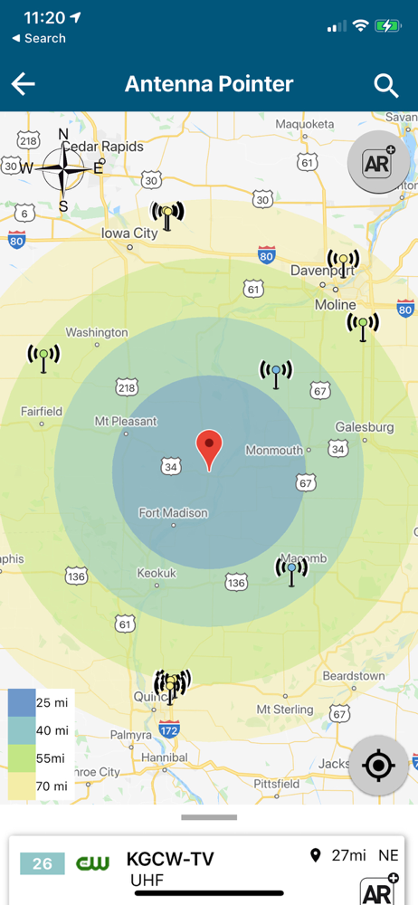
Recently downloaded app and found that while it shows me the various towers, I’m not sure of their relative location to my present location. It does not display any map information just colored range rings. No roads, Lakes, towns just nothing that can be used to verify direction. And I did allow it access to my location. AR mode is okay, just have to guess at the bearing to the tower. It’ll do I suppose until something better comes along. As it stands I hesitate to recommend to my fellow RV’ers.
Winegard® creates connectivity while at home, tailgating, trucking, or RVing by helping you view your favorite shows with this smart TV Signal Finder...