App Profile: Free Map Tools

Android / Games / Puzzles
Free Map Tools
Installs:
Rating:
0.00
Total Reviews:
0
Top Countries:
GB, US, AU
< $5k
/mo
< 5k
/mo
Reviews: What People Think About Free Map Tools
19donuts
Rating: 4/5
i love how useful this app is…i use it every time i try a new walking route so i can keep track of my distance and gauge my speed. i do wish that the contrast for the printing in the black boxes for the route saving page was sharper, and i haven’t been able to find a list for my saved routes, so the ones that i can’t remember the names for are lost to me - especially since i can’t read the writing if they are there. i hope the elevation tool works, because i just noticed that it was there!
Gill Bros
Rating: 3/5
This is a Good , but is missing some features like how far towards our radius starting point, The Highways or that we are traveling are not enhanced so that we can see where we are going,the App needs to show us as tracking up,not from top down, if where traveling North to South.
The Blinking Dot show our location, should a “ Chevron Blue Arrow “ showing the the direction of our travel, just little things.
Also maybe for Truck drivers the time of ETA at Truck Driving speeds.
Thx
Windkisssed
Rating: 3/5
But it keeps crashing on me. I tried distance between, put in first address it doesn’t show it...I have to locate it myself on map...then it crashes.
I tried how far can I travel, once again had to find myself, crashes.
It’s too frustrating to keep finding things on map to have crash & start over.
Keep up the work...maybe you’ll get it
About Free Map Tools
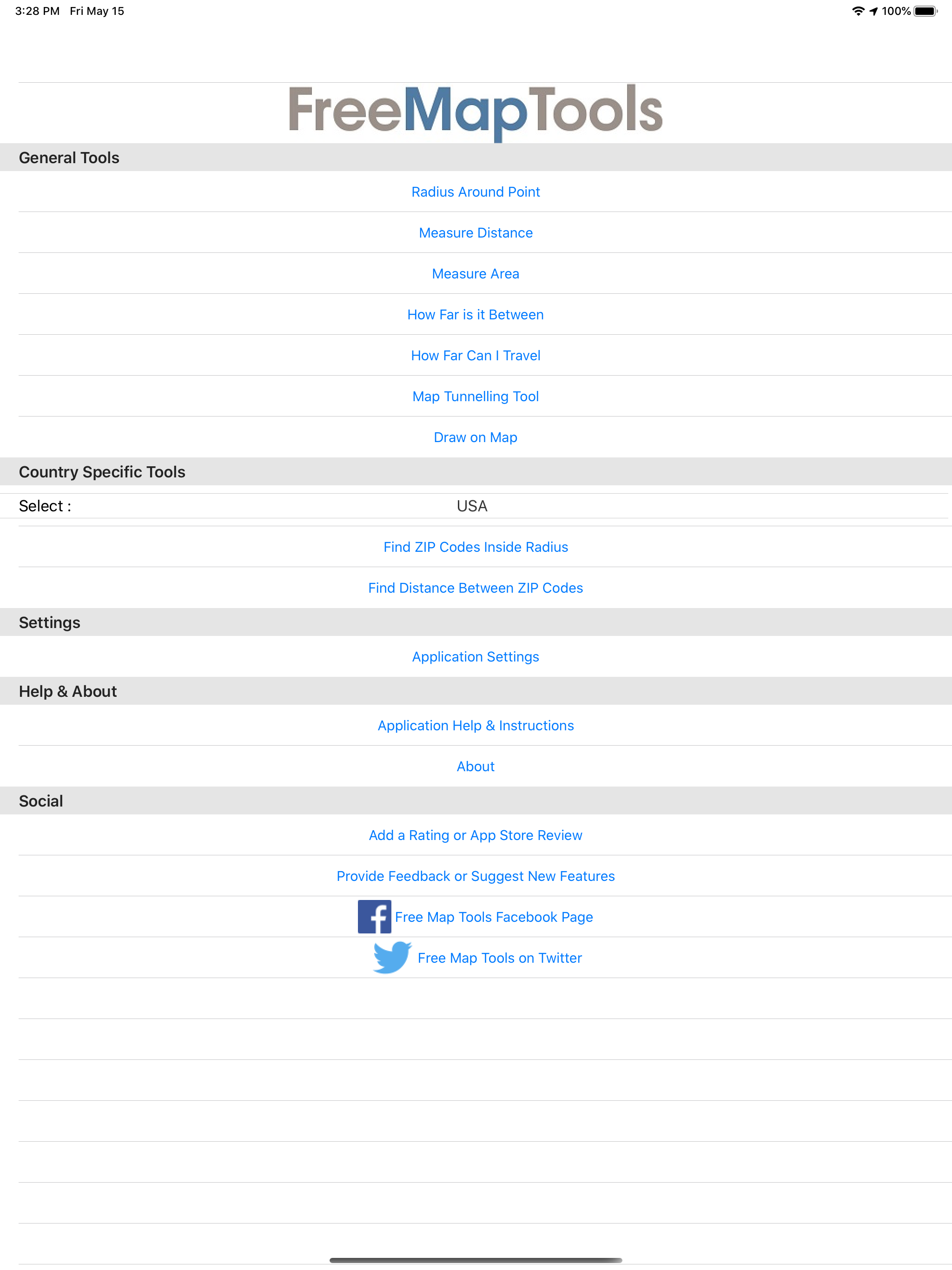
Free Map Tools is a collection of tools based on maps. These tools allow you to perform various functions for a wide range of applications. You can measure distances and areas. You can also send or share the map as an image to indicate the area, route or radius you have plotted.
The Radius Around Point tool lets you plot a distance radius on a map. You specify the centre point, the radius and other features such as colour. You can then visualise the radius to see the area covered.
The Measure Distance tool lets you plot a route on a map and find out the distance covered in various units. It also uses your GPS sensor to plot the route automatically.
The Area Calculator Tool lets you draw an area on the map and find the measurement of the area enclosed.
The Find How Far I Can Travel tool will show how far you can drive or walk within a set time. For example, how far can I get if I drive for 60 minutes from my current location.
How Far is it Between allows you to find the road and crow-flies distance between 2 addresses. It also shows both routes on the map.
The Map Tunnelling Tool allows you to find out where on the globe your antipodal point is. You can also find the antipode of any custom location.
Country Specific Tools
———————————————-
For the following countries:
∙USA
∙UK
You can use the following tools:
∙The zip/postcodes found inside a radius
∙The distance between two zip/postcodes
File size: 6363136
Launched countries: GBUSAUCACNFRDEITJPKRRUDZAOARATAZBBBYBEBMBRBGCLCOCRHRCZDKDOECEGSVFIGHGRGTHKHUINIDIEILKZKEKWLBLTLUMOMGMYMXNLNZNGNOOMPKPAPEPHPLPTQAROSASGSKSIZAESLKSECHTWTHTNTRUAAEUYUZVEVNBOKHEELVNIPYMZYEBHCYMTBJBFCGJOLAMLSNTZUGZW
Minimum OS version: 13.0
Release Date: 1454619554000
Published by GV Software Solutions Limited
Website url: https://www.gvsoso.com/
Publisher country: