
Check the acquisition promise
Read the store headline, screenshots and description. What problem is the app promising to solve?
Study the storefront ↗
MapRight, LLC · iOS
Explore the ad evidence, study the storefront, and build your next acquisition hypothesis.
01 / Creative research
Read the store headline, screenshots and description. What problem is the app promising to solve?
Study the storefront ↗Explore apps with direct store-link matches. Compare their hooks and formats without assuming the same approach works here.
Browse observed advertisers ↗Store rankings and revenue estimates describe market context. They do not establish ad spend, conversions or ROAS.
Review the market context ↗02 / Storefront & product
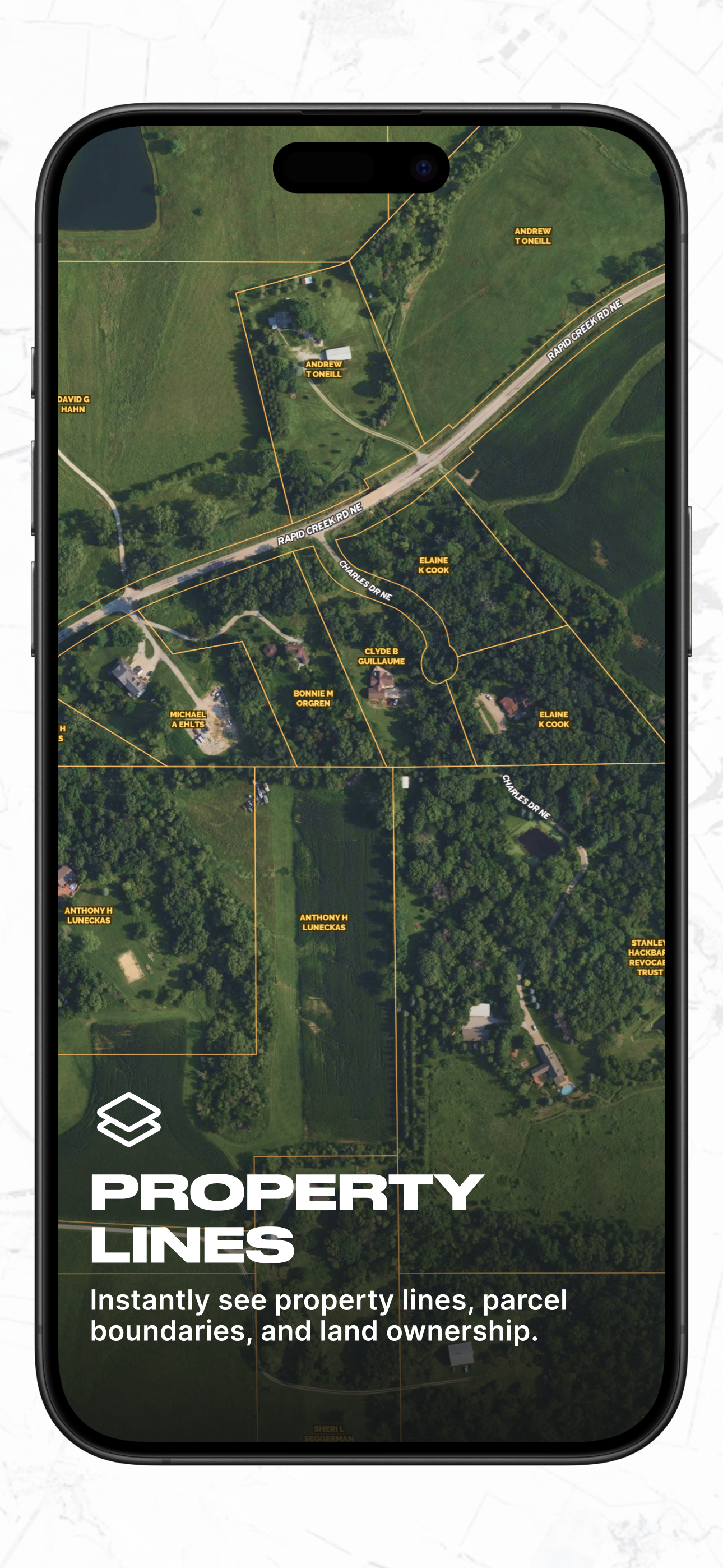
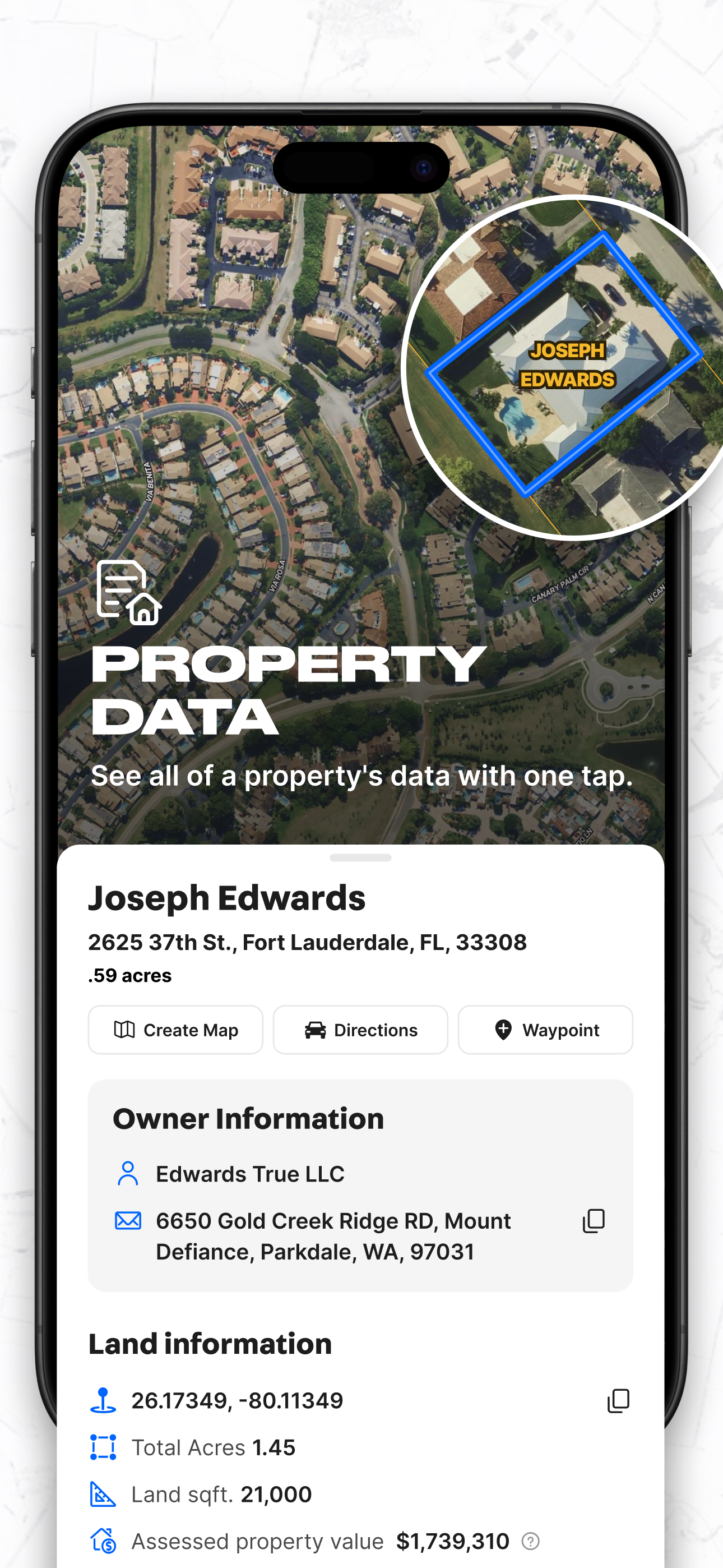
Study the product story and store experience behind the acquisition funnel.




03 / Market context
Keep revenue, downloads and store rankings separate from advertising performance.
A must for anyone in land acquisition, land development, and real estate! One of the most impressive aspects of Land id™ is its ability to provide nationwide property ownership details with just a few taps. This is invaluable for developers, land buyers, and investors who need quick access to parcel data, ownership records, and boundary lines without having to dig through county records. If you work with land in any capacity, whether as a developer, investor, surveyor, or outdoor enthusiast, Land id™ is an indispensable tool. It combines cutting-edge GIS mapping, detailed property data, and an easy-to-use interface into one powerful platform. The ability to analyze land parcels, mark boundaries, and navigate property in real-time makes this app a must-have for anyone dealing with land and real estate. A Few Key Features: Parcel Boundaries & Ownership Info: Instantly see property lines and ownership details for any location. Zoning & Land Use Data: Helps investors and developers make informed decisions before purchasing. Public & Private Land Data: Perfect for hunters, outdoor enthusiasts, and conservationists. Satellite, Topographic, and Hybrid Maps: Easily switch between views to analyze terrain, elevation, and land features. GPS Integration: Navigate properties in real-time with precise location tracking—a must-have for on-the-ground property assessments. Customizable Map Overlays: Add your own data layers, boundary markings, and notes for detailed land analysis.
I’ve been using this app almost every day for the last 2 years for identifying investment properties - and managing my own property. The map creation and sharing capabilities really set this app apart and combined with the comprehensive property ownership coverage and other layers it is a winner. I can turn on and off layers like FEMA flood plains, wells, aquifers, school districts, contour lines - and see what is impacting specific properties and their value. I can even import plat maps and see them directly on the map! There’s also way more detailed property information than you would find in other apps. I’ve been turning on all my real estate agent friends to Land id and they are all switching to it. Couldn’t be happier with this app!
Easiest access to full real estate info on parcels, including ownership, boundaries, buildings, taxes, loans, school districts, etc, etc. Building maps of my land is easy too for sharing with friends and family for recreation or doing construction planning and sharing with subcontractors for bids or county planners for permitting and project approvals. Love the combination of easy map creation/ sharing with the deepest/ most accurate real estate information I can find anywhere. Is equally useful for managing my land as well as researching new parcels or projects of interest, especially when real estate agents have already built an interactive Land id map of their listings that they can share with me. I have also found that it saves me a fortune on my land research and development projects too. Easy for me to quickly make a track to measure/ route a potential roadway/ trail, measure a footprint for a new building or pond, measure a fence, mark/ measure areas for noxious weed spraying, establish clear building setbacks for in-field use … all of which I can then easily share with whomever I want. Every day I use Land id I come up with a cool new use for it! Well done to the Land id team. Please keep the innovations coming ...
Land id® turns AI-driven parcel insights into shareable property stories that drive real estate decisions. Explore properties, parcel boundaries, land...
| Name | Price | Type |
|---|---|---|
| Land id Monthly | $14.99 | Monthly |
| One state parcels plan (Monthly) | $18.99 | Monthly |
| Land id Premium Monthly | $20.00 | Monthly |
| Individual Unlimited Plan (Monthly) | $44.99 | Monthly |
| Land id Pro Monthly | $49.99 | Monthly |
| Land id Pro Unlimited Monthly | $79.99 | Monthly |
| Land id Annual | $84.00 | Yearly |
| Land id Premium Annual | $143.99 | Yearly |
| Land id Pro Annual | $400.00 | Yearly |
| Land id Pro Unlimited Annual | $800.00 | Yearly |


