Check the acquisition promise
Read the store headline, screenshots and description. What problem is the app promising to solve?
Study the storefront ↗
Eastridge Technology · iOS
Explore the ad evidence, study the storefront, and build your next acquisition hypothesis.
01 / Creative research
Read the store headline, screenshots and description. What problem is the app promising to solve?
Study the storefront ↗Explore apps with direct store-link matches. Compare their hooks and formats without assuming the same approach works here.
Browse observed advertisers ↗Store rankings and revenue estimates describe market context. They do not establish ad spend, conversions or ROAS.
Review the market context ↗02 / Storefront & product
Study the product story and store experience behind the acquisition funnel.



03 / Market context
Keep revenue, downloads and store rankings separate from advertising performance.
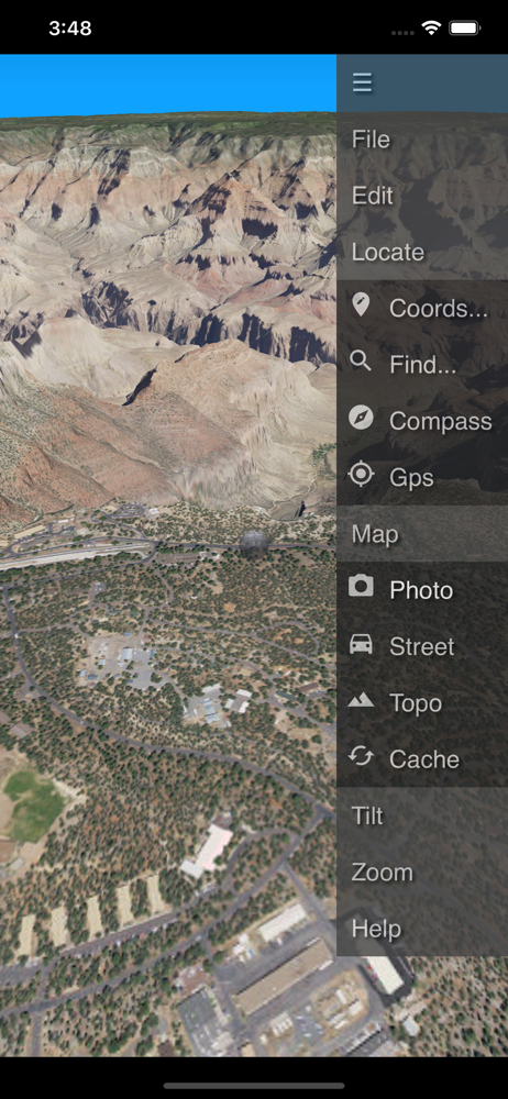
Love using this app to get an idea of the terrain of an area! Been using this app for a couple years now, primarily for planning. Some of my favorite features are being able to switch maps to 3 different satellite image sets, us topo, historical usgs topo, and using waypoints make it easy to go right to a place on the map. Offline maps are cool too but I haven’t used this as much as other map apps or even paper maps in the field. My only problems with this app are that sometimes the maps take a while to load or don’t load at all, restarting the app helps sometimes but i’m currently having an issue loading a part of the map I’m interested in. Also it crashes sometimes. But when it works smoothly it’s an awesome app!!! I’m in the US in the NW and I love to use this app to get my mountain views in when I can’t get to the mountains! Can also help you see how steep a road or trail is if you go offroading hiking hunting whatever! Does have kind of different controls if you’re used to other map apps, pinching the screen top to bottom changes the viewing angle and pinching from the sides to the center or out from the center changes the zoom.
The map information is hard to see. And, the map labels are upside down.
Route3D is a three dimensional map for outdoor activities. Maps are displayed in perspective and with hills. You can play back routes like a movie, sh...