
Check the acquisition promise
Read the store headline, screenshots and description. What problem is the app promising to solve?
Study the storefront ↗
Mobile Card Games & Travel Apps LLC · iOS
Explore the ad evidence, study the storefront, and build your next acquisition hypothesis.
01 / Creative research
Read the store headline, screenshots and description. What problem is the app promising to solve?
Study the storefront ↗Explore apps with direct store-link matches. Compare their hooks and formats without assuming the same approach works here.
Browse observed advertisers ↗Store rankings and revenue estimates describe market context. They do not establish ad spend, conversions or ROAS.
Review the market context ↗02 / Storefront & product
Study the product story and store experience behind the acquisition funnel.


03 / Market context
Keep revenue, downloads and store rankings separate from advertising performance.
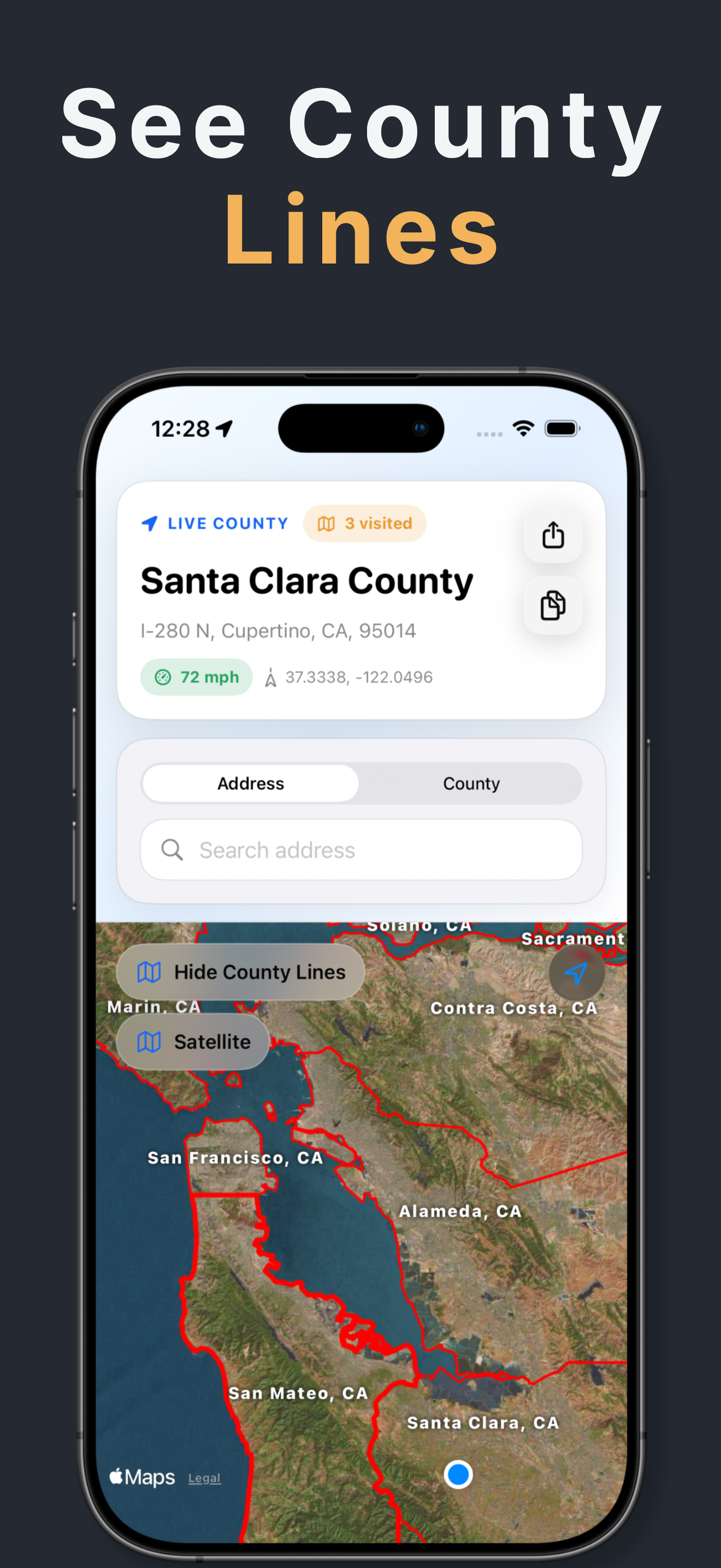
I genuinely love this app. I have paid for the premium version, and I use it all the time as I tend to travel a lot. Tells you what county you’re in and you can see the actual county lines and your live location on the map as well. Counties change as you continue to move, it is cool. Also can use app as a compass as it’s built in and screen will move as you torn your phone. I love this app!!!
I paid $2.99 to be able to view county lines, but the labels are so big that they severely limit the utility of the app/layer. Town names are in 8pt font the way they are on Google and Apple Maps. But the county names are in 20pt font, and they don’t shrink when you zoom out. I wish reviews allowed you to post screenshots, because the zoomed out view of the state of Virginia is just a block of a ton of large county labels layered over one another so you genuinely can’t make out any of them. Please! Make the county name labels responsive to zooming in/out, and please either add a toggle to change the font size from big to small or just make them ~10-12pt font consistently. I don’t think that this would be a difficult patch! With that, please add a toggle to make the county lines thinner, or make the lines responsive to zoom also. Lastly, it would be very helpful if you could view the county names written along the lines when you’re zoomed in, like the way state lines are shown on Google/Apple Maps. As it stands, you have to zoom out to view the labels when you’re looking at a county line. But don’t zoom out too far, or you won’t be able to read it at all. Also, if you added polygons for town boundaries, park boundaries, etc, lines for streets (so you can highlight an entire road instead of only one point on it) + the ability to search by place names (ie “Baltimore Washington International Airport” or “Shenandoah National Park”) I would be happy to pay a monthly subscription fee, because the app would become enormously useful to me. As of now, it’s not even worth the one-time purchase at $2.99 because the labels are so badly done. I want them fixed or I want my money back.
In target marketing, marketing research sampling, political science, etc it has always been a pain to get the county geography. Trying to pull FIPS codes from census and merge them into an address perspective was always difficult. So glad to have this easy to use app to get the county view. Do pay the in app purchase cost to get the county line addition as it is much faster if you are wanting to see a bunch quickly.
Road signs do not always tell you when you crossed a county line. County Lines & Names shows your live county, address context, speed, and FIPS detail...
| Name | Price | Type |
|---|---|---|
| County Lines and Names | $2.99 | One-time |
| County Names & Lines Weekly | $2.99 | Weekly |
| County Names & Lines Monthly | $4.99 | Monthly |
| County Names & Lines Annual | $14.99 | Yearly |
| County Names & Lines Annual | $24.99 | Yearly |


