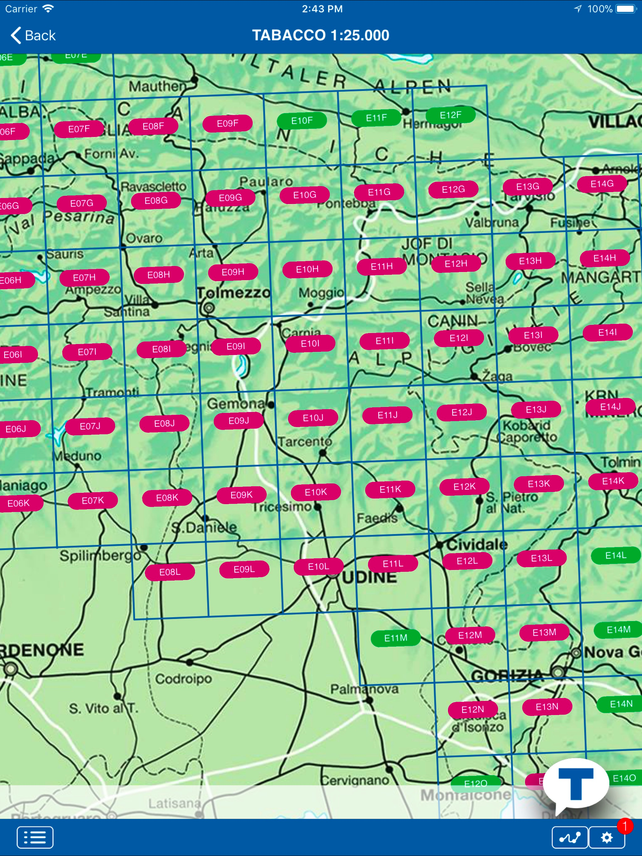
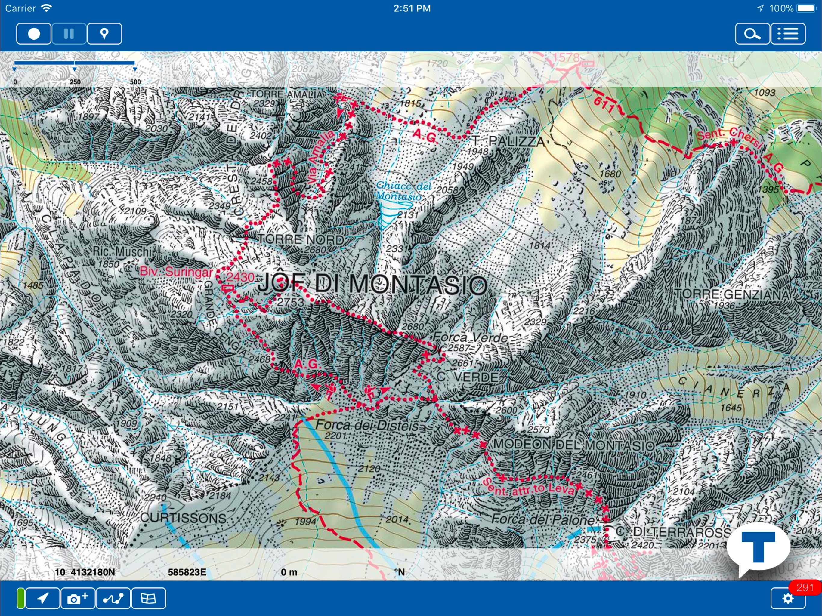
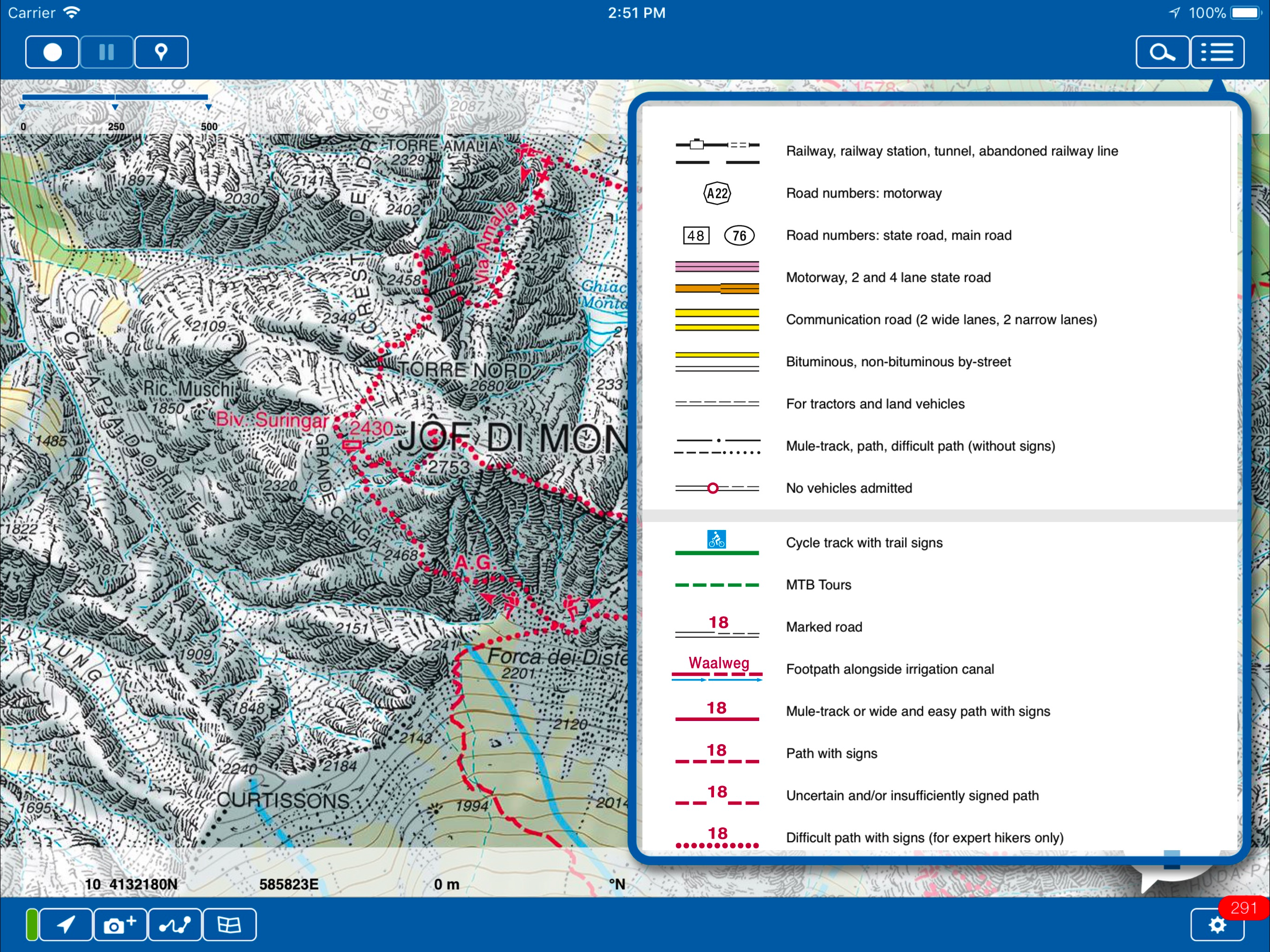
App Profile: TABACCOmapp

Android / Games / Puzzles
TABACCOmapp
Installs:
Rating:
2.33
Total Reviews:
9
Top Countries:
IT, DE, US
< $5k
/mo
< 5k
/mo
Reviews: What People Think About TABACCOmapp
DgOnAS
Rating: 3/5
I was very excited at first to finally find a mapping app with an exhaustive set of marked and unmarked trails for the Dolomites area. The disappointment came with finding significant branches of marked (CAI) trails to be missing from the app maps though they are present on the paper version. Hopefully they will get enough feedback to take care of these issues.
Sampson twelve
Rating: 5/5
Used this app while hiking the AV1. It exceeded my expectations. I downloaded the necessary map sections before leaving for my hike (from Lago Di Braies to Belluno).
The integrated GPS is very helpful. The GPS position identifier is shaped like a pointer, so you just point your phone at a trail intersection to figure out which way you need to go.
It was also nice for tracking progress along the trail and making sure I was on the right trail.
I HIGHLY recommend this app.
Plus, the few sections I bought on the app ended up being cheaper than the paper maps.
nogood^3
Rating: 3/5
Buggy. Can’t open downloaded maps. No help.
About TABACCOmapp
Finally, the high quality of the TABACCO maps in digital. The application is free and you can buy the Tabacco maps divided into modules map. The application also allows you to share your trips on a community www.tabaccomapp-community where you can review your trips in 3D!
VIDEO DEMO: to get an idea of what you can do, view this video:
http://www.youtube.com/watch?v=e2HR-cYIOXg
USERS:
The application is suitable not only for hiking, trekking and Nordic Walking enthusiasts, but also for those who prefer MTB excursions or, in winter, snowshoeing or ski mountaineering.
FEATURES:
WARNING: "Continued use of GPS running in the background can dramatically decrease battery life."
ZOOM: The maps can be zoomed out for an overview, or in to explore the terrain in minute detail. You will appreciate the high quality of the digital maps!
TRACK RECORD: Via the GPS incorporated in the device, you can save your own excursions, assigning a different color and a description to each one for instant recognition.
SIGNALS: Within the excursion, you can identify various POI, to which you can assign icons selected from the large number available (for example: parking place, footpath interrupted, old military station, mountain pass, etc.).
SHARING: Trails and waypoints are immediately available for sending by e-mail by simply TAPPING an icon.
IMPORT: It’s possible to export your own trail, and just as easy to import one suggested by a friend and supplied in the form of a .gpx file, complete with waypoints.
PHOTO: Photos taken along the way will be saved and georeferenced for possible future use.
AR+: Using the Augmented Reality (AR+) facility, when you look at the horizon with your device you will be able to recognize mountain peaks with their name and height, mountain cols and passes, mountain refuges, bivouacs and locations, based on a user-defined kilometric distance scale.
CATALOGUE OF MAPS – How to buy them: From the application itself, you can access a catalogue that provides images of maps already purchased, of those available for purchase and of those that will shortly be available.
SAFETY SERVICE: One of the most important features of this application is the “safety service”. This function allows users, who must first have registered, free of charge, on the www.tabaccomapp-community.it web site, to indicate someone they trust who, if required, will be able to follow the excursion in real time, also with a 3D display. The importance of this function is essentially that of being able to give the hiker’s last known position to the rescue services, in the unfortunate event of an accident. This function is only active if a mobile telephone signal is available.
File size: 39408640
Launched countries: USAUCACNFRDEGBITJPKRRUDZAOARATAZBBBYBEBMBRBGCLCOCRHRCZDKDOECEGSVFIGHGRGTHKHUINIDIEILKZKEKWLBLTLUMOMGMYMXNLNZNGNOOMPKPAPEPHPLPTQAROSASGSKSIZAESLKSECHTWTHTNTRUAAEUYUZVEVNBOEELVNIPYKHMZYEBHCYMTBJBFCGJOLAMLSNTZUGZW
Minimum OS version: 9.0
Release Date: 1344032452000
Published by Casa Editrice Tabacco S.r.l.
Website url:
Publisher country: Italy