iSailGPS : NOAA USA RNC Charts
James Associates Inc.v9.6.6
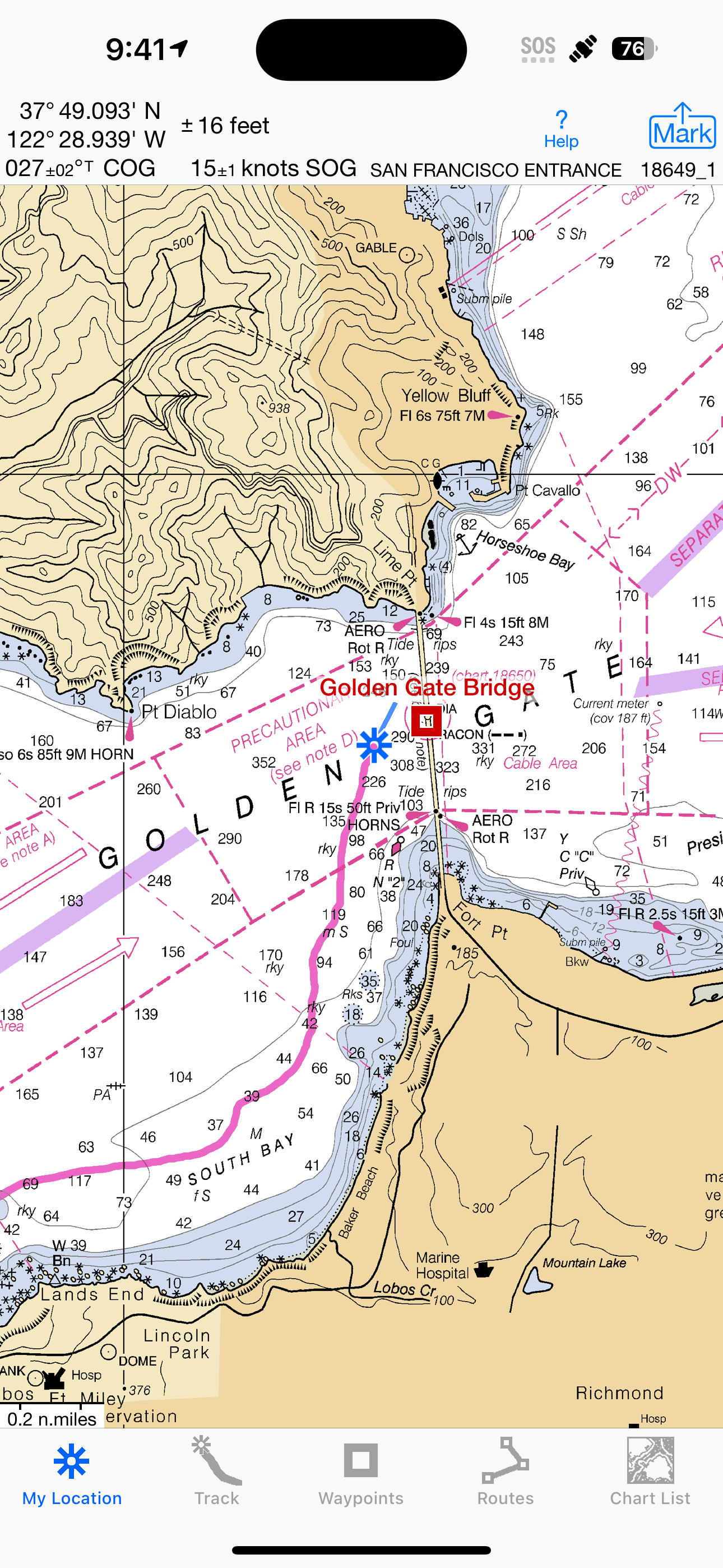
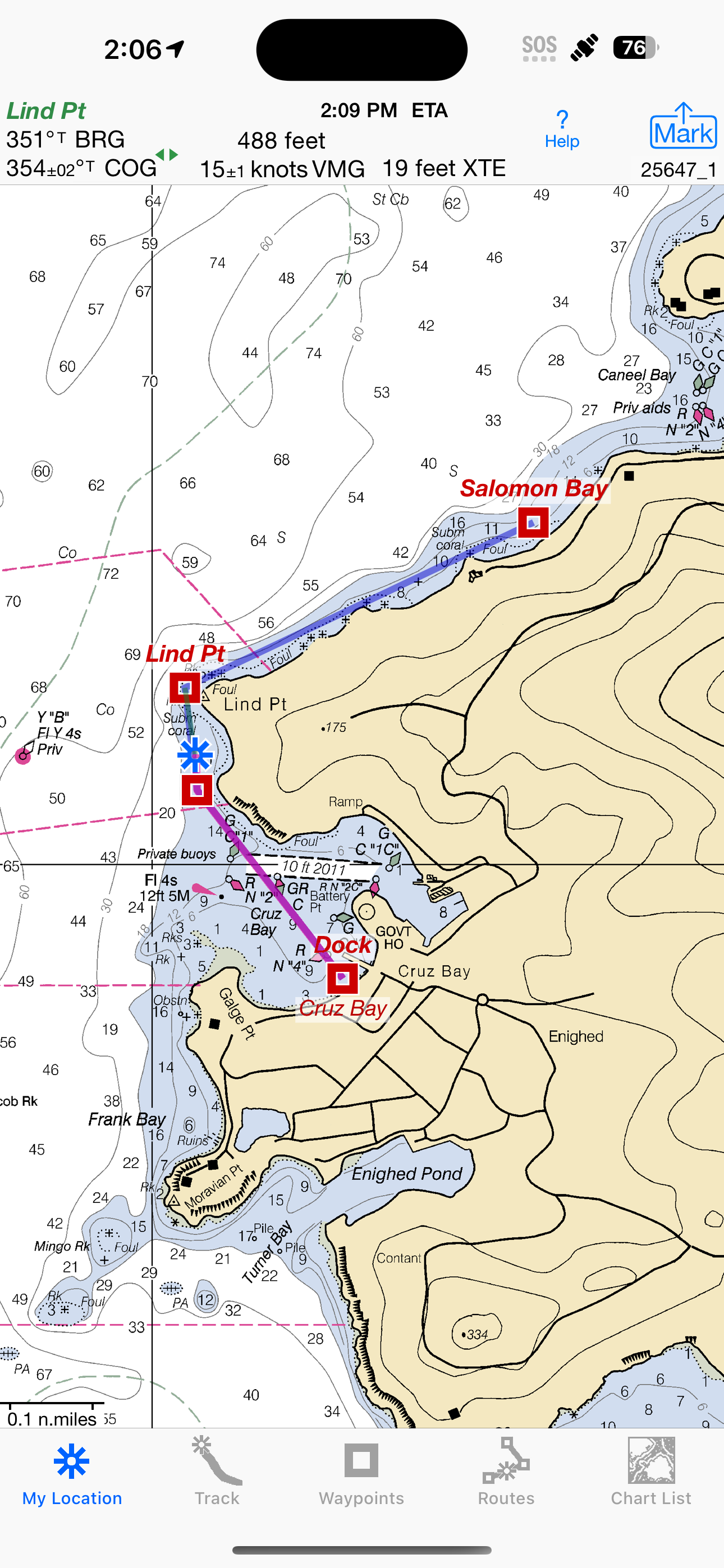
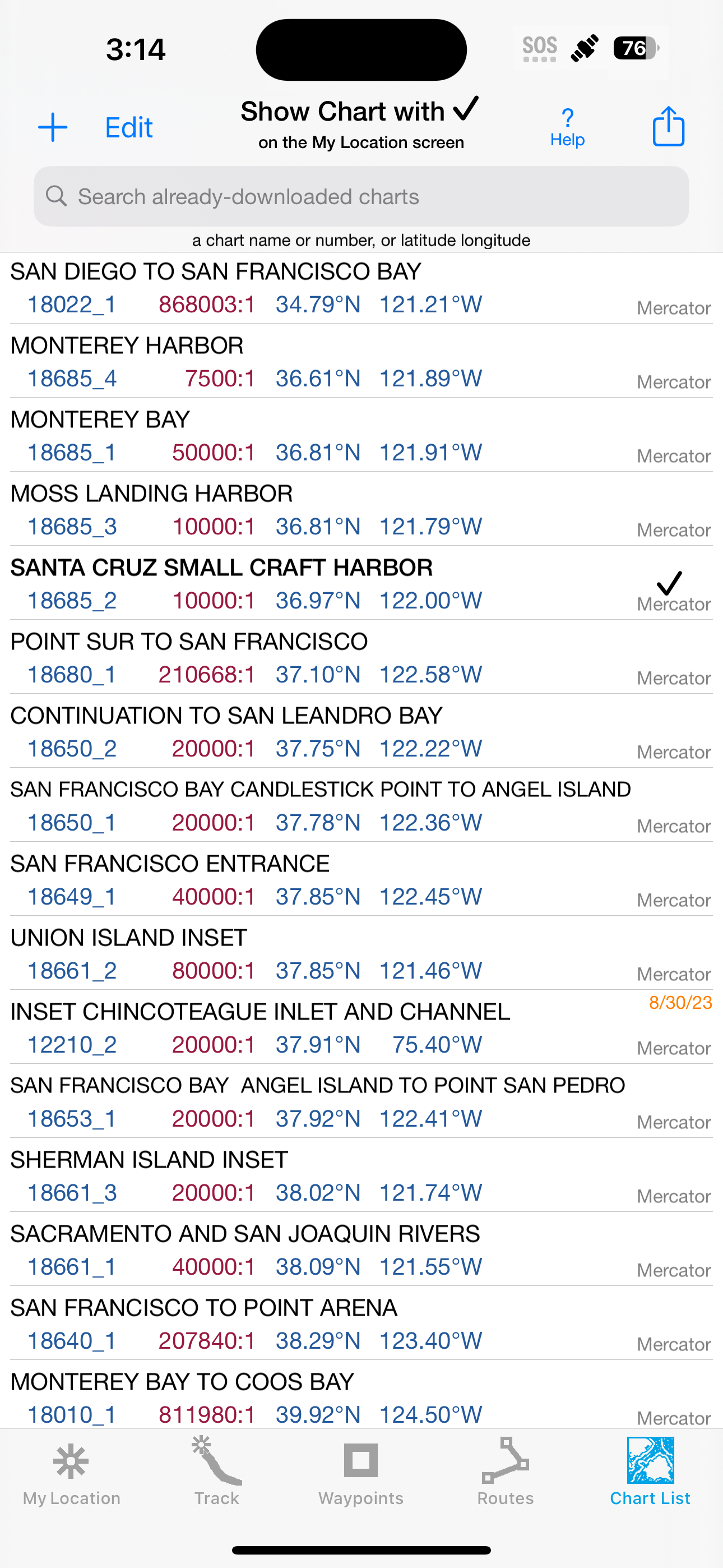
Screenshots


How Much Does iSailGPS : NOAA USA RNC Charts Make?
Platform Performance
Rating Distribution
Top Countries
Reviews (3)▼
The main problem for me is the inability to stitch together a see less chart and being able to get the best detail for the area automatically. I’ve been playing with app for awhile now and when I get to the chart boundary I can often get the next chart to show by double tapping the white area outside of it. And sometimes, I think, it seems to have successfully stitched together into a single, larger chart. But, it may not have the sufficient detail I need for a particular port. At that point I’m forced to go to my downloaded charts and find it. Not so simple as I now have a long list of charts. This can be impractical to do on the water unless you have a dedicated navigator. When approaching a busy area I don’t want to take my eyes off the water and be scrolling through a list of charts trying to find the appropriate detail. Maybe I’m missing something but for me other apps with paid subscriptions work a lot better. There’s just no chart management needed, and you can find them for as little as $5/year (at least for my area - eastern US coast).
After investing a little time to understand this app, I found it to be extremely valuable and accurate. I was won over, when we used it to navigate across the Chesapeake Bay at night. The waypoint marker we were heading to was supposed to be a flashing light but the light was out and we were a little uncertain that we were on course. When we suspected we should be at our destination marker we turned on our spot light and found ourselves perched with the marker on our port quarter. Can’t believe this app is only $7.99.
I’ve been using this app for about a year and I’m extremely happy with it. I can set waypoints and routes right on the app just like I would on a chart. Then follow the route, and even reverse it on my iPad or iPhone. I can send a route from my iPad to my iPhone and it brings the waypoints with it. You can take a screenshot of the route and print it out, so you can check off each waypoint as you pass it. They even added the latitude and longitude of each waypoint to the route screen. They’re very responsive and I highly recommend this app.
Version History (106)▼
Available In (115 Countries)▼
Supported Languages (1)▼
App Details▼
Unleash the navigation potential of your iPhone or iPad with SailGPS! Turn your device into a high-performance GPS receiver with USA NOAA Raster Nauti...
Similar Apps