
Screenshots


How Much Does VFRnav Flugnavigation Make?
Platform Performance
Rating Distribution
Top Countries
Reviews (3)▼
Das Programm hat alles, was ich als Gelegenheitsflieger zur Unterstützung brauche und bleibt dabei sehr übersichtlich.
Nutze diese APP nun seit einem Jahr und bin wirklich begeistert. Der sehr günstige Preis, die Übersichtlichkeit und einfache Bedienung überzeugen einfach. Habe zwischenzeitlich auch andere Navigationsapps genutzt, doch das Gesamtpaket stimmt hier einfach. Insbesondere wenn man das Preis/Leistungsverhältnis berücksichtigt. Gelegentlich hatte ich Probleme mit der Verbindung zum Stratux, doch auch das funktioniert jetzt wieder einwandfrei. Daher klare Empfehlung!
Ich habe schon einige Programme getestet und bin durch einen Freund auf VFRNav gestoßen. Die Klarheit und Einfachheit sorgt genau dafür, dass man sich auf das Wesentliche konzentrieren kann, das Fliegen. An vielen Plätzen sind ebenfalls die Platzrunden integriert und beim Antippen der Lufträume werden die FIS Frequenz und die Limits angezeigt. Das Programm läuft dazu auf dem iPhone absolut stabil, so dass es mein Begleiter für viele weitere Flüge sein wird. Danke !
Version History (103)▼
Available In (24 Countries)▼
Supported Languages (8)▼
App Details▼
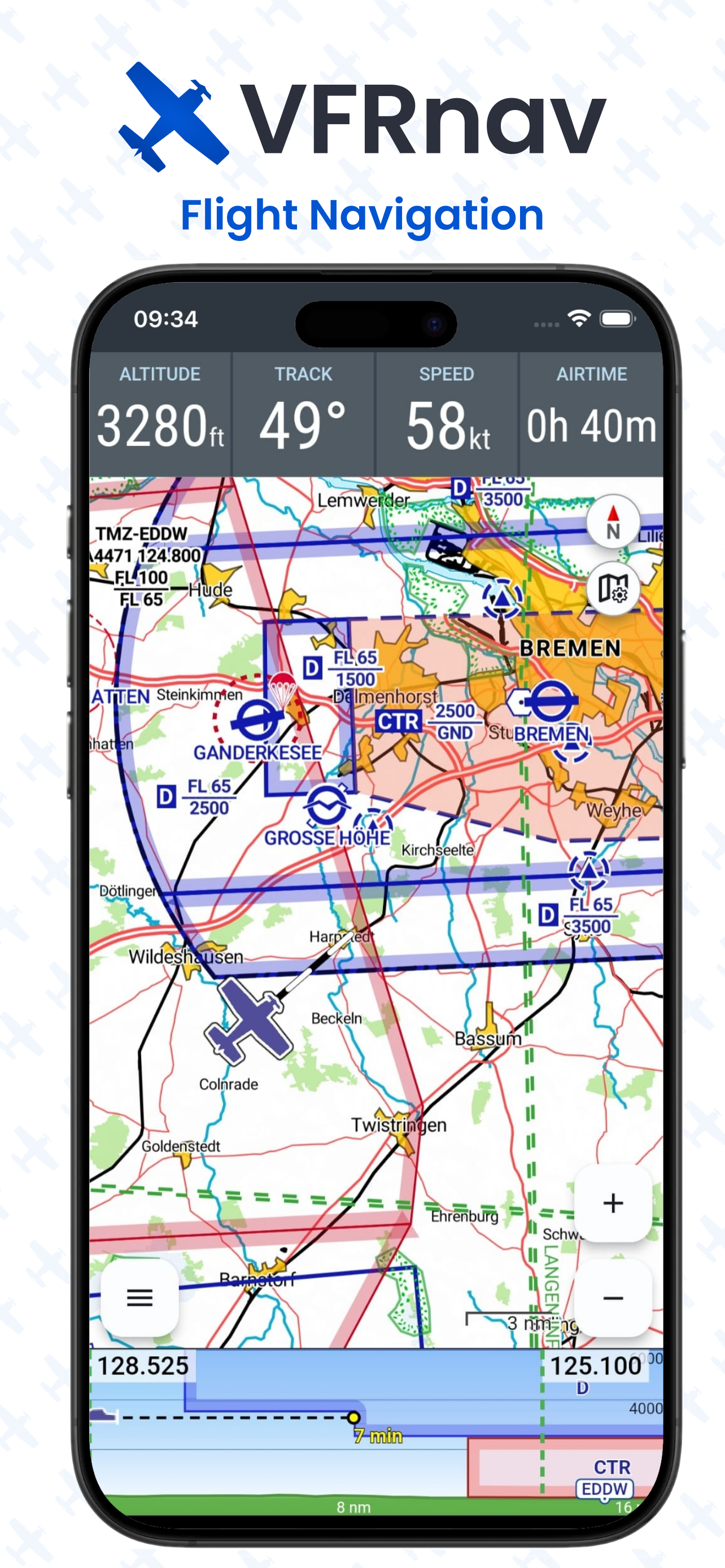
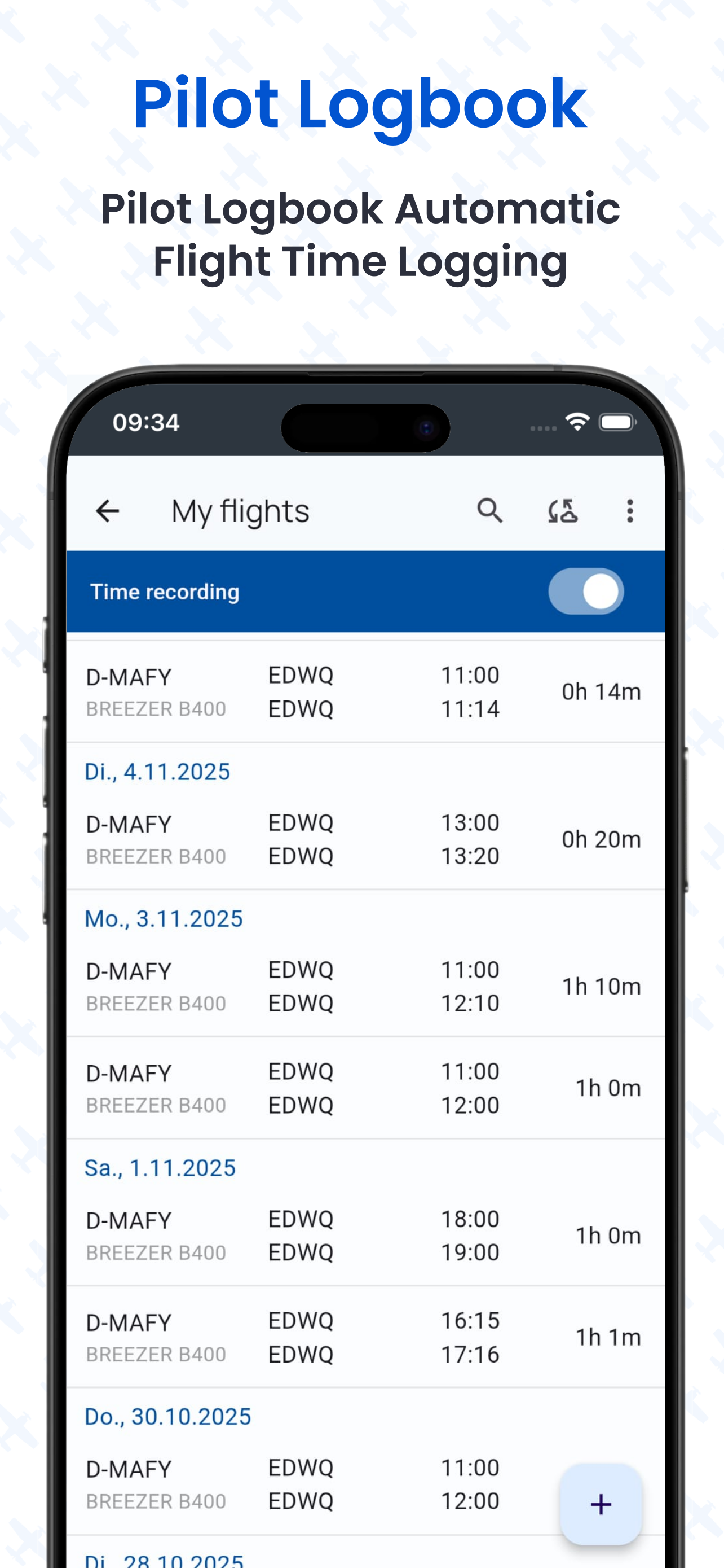
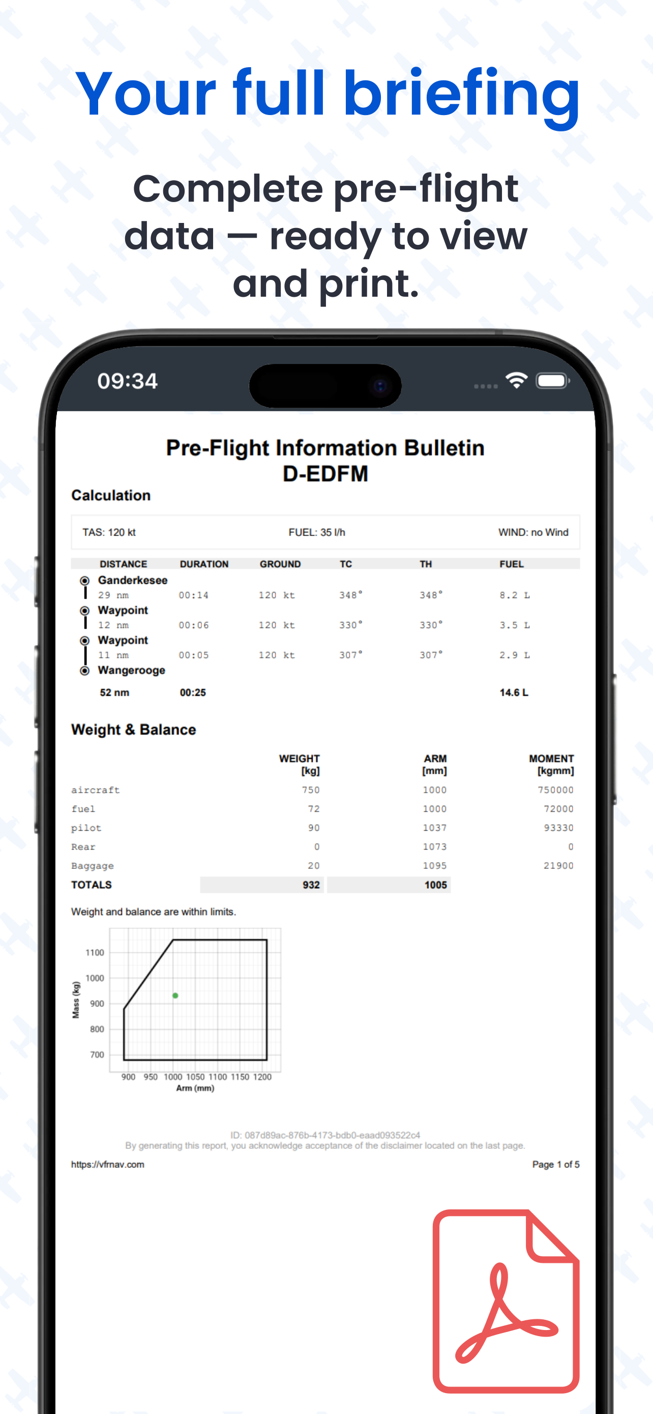
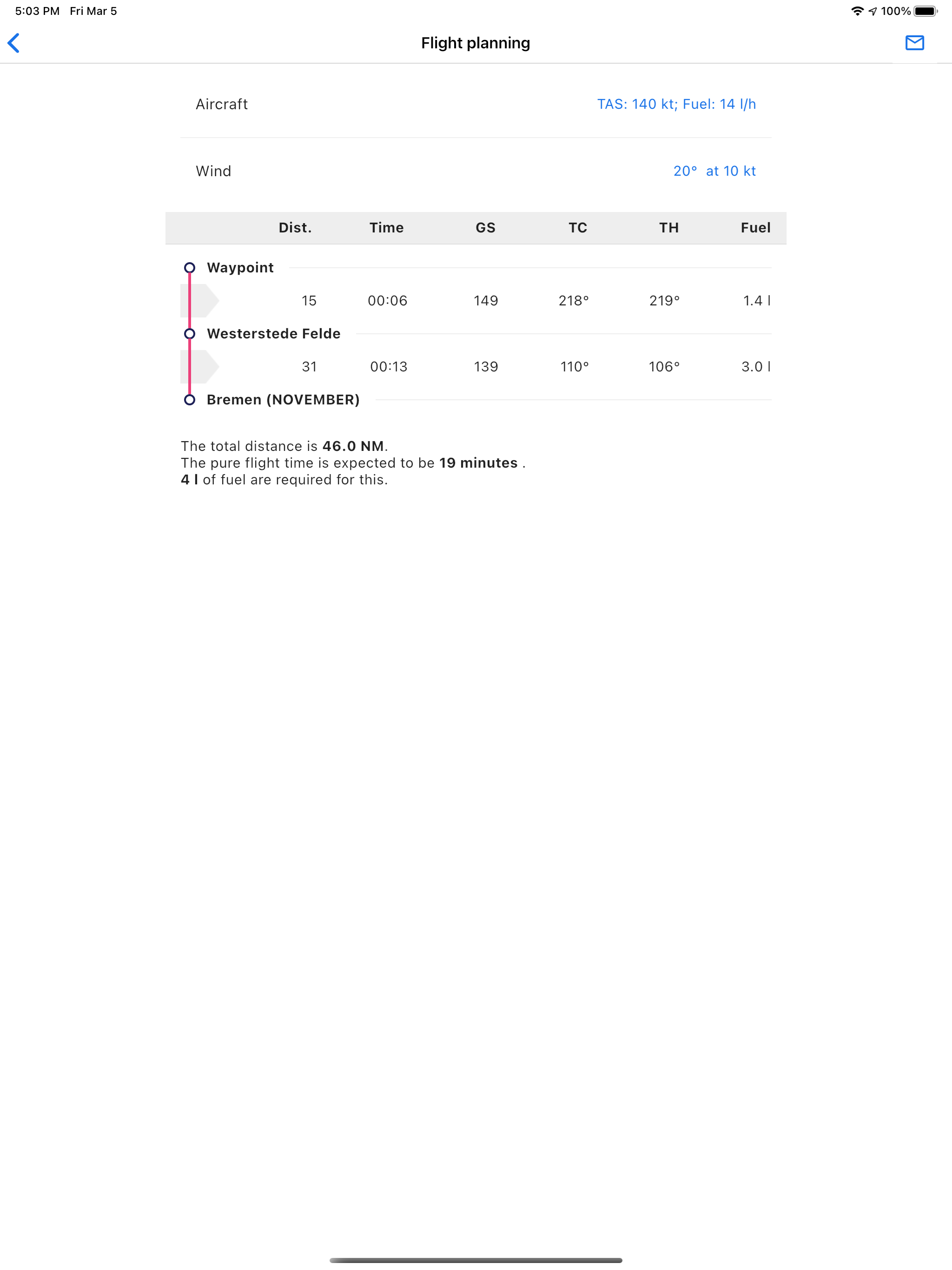
VFRnav ist eine Navigationsanwendung, die speziell für die Anforderungen von Piloten im Sichtflug (VFR) entwickelt wurde. Die Anwendung kombiniert ein...
Similar Apps


