Screenshots


How Much Does iNavX: Marine Navigation Make?
Platform Performance
Rating Distribution
Top Countries
Rankings
Reviews (3)▼
I recently tried out the iNavX app on both my iPhone and iPad, primarily attracted by its high-resolution charts. Unfortunately, the overall user experience didn't measure up to competitors like Navionics and Navily, which I find to be much more intuitive and user-friendly. The charts on iNavX are indeed of good quality and detail, which is a strong point for the app. This might be particularly appealing for those who prioritize visual clarity and precision in marine navigation. However, when it comes to ease of use, iNavX falls short. The interface feels less intuitive, and navigating through the app is more cumbersome compared to the smoothness of Navionics and Navily. Given my experience, I'll continue to rely on Navionics as my primary navigation tool. iNavX, while having its merits in chart resolution, will only be used on an as-needed basis due to its less user-friendly setup. For anyone considering iNavX, be prepared for a bit of a learning curve if you're already accustomed to more streamlined apps like Navionics.
Everywhere you look you would think you can use Navionics Maps - nope, no longer available. Oh, how about C-Maps? These are even listed on recent advertisements - Nope, no longer available. But, you can purchase the INavX maps subscription for $60, in addition to the cost of the app. Or, you could go straight to Navionics and use their maps for $20 with their free app, or go to C-Maps and use their maps for $15 with their free app. Oh, but INavX does let you use the old NOAA raster maps for free, but then so does pretty much every other free app out there. Might be a good app - don’t know, not going to pay 3 to 4 times more for their maps than the extremely highly rated and industry standard Navionics or C-Maps. Knowing this in advance I would have never purchased this app.
I really cannot understand the recent (and few) negative reviews... I am slipped in the Santa Cruz, California small craft harbor. I have 20 year old integrated Raytheon electronics (fish finder, radar, chart plotter) and following the tsunami that hit our harbor, I lost the chart plotter functionality. Knowing that to replace my integrated system would cost me over 10K, I 'rolled the dice' and downloaded INavX to 'temporarily' replace the plotter as I was not prepared to haul out, $$$, etc. Well, over two years later I still am not planning a haul out for electronics as... I now am very satisfied with my IPAD/INavX next to my radar and fish finder. I currently have all my fishing and important navigation coordinates loaded and adding new ones regularly with a tap of the stylus. In actuality, don't even miss my old chart plotter... Thank you INavX... Captain Rich Bonny-Matit
Version History (130)▼
Available In (115 Countries)▼
Supported Languages (7)▼
App Details▼
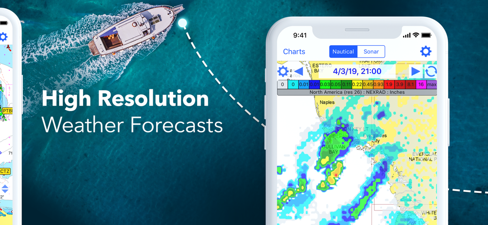
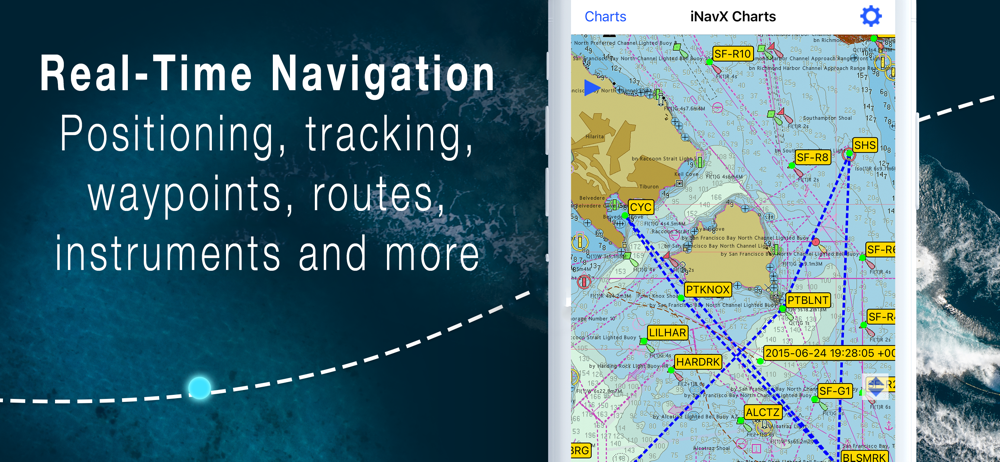
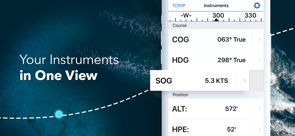
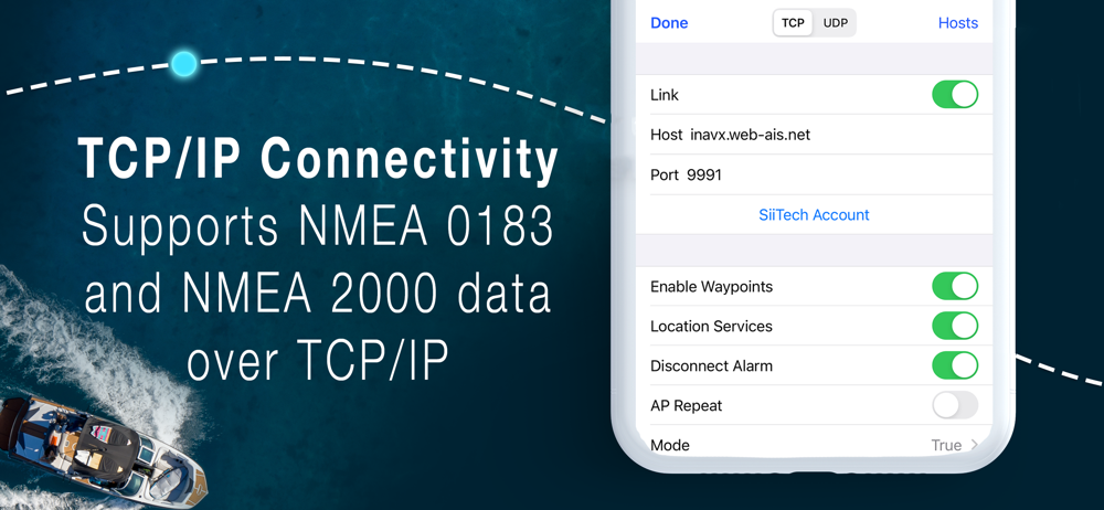
Marine navigation is made easy with iNavX - the world's #1 handheld Chartplotter. Access marine charts, maps, weather, AIS and more! iNavX is the onl...
In-App Purchases (10)
| Name | Price | Type |
|---|---|---|
| Theyr Premium - Mobile (Monthly) for iOS | $9.99 | Monthly |
| Navionics+ USA/Canada (iPhone) (Annual) | $29.99 | Yearly |
| iNavX Professional+ USA (Annual) | $29.99 | Yearly |
| Navionics+ Caribbean (iPhone) (Annual) | $44.99 | Yearly |
| Theyr Premium Weather (Annual) | $49.99 | Yearly |
| C-MAP World Chart (Annual) | $59.99 | Yearly |
| iNavX Professional+ USA Canada (Annual) | $59.99 | Yearly |
| Navionics+ Caribbean (iPad) (Annual) | $79.99 | Yearly |
| Navionics+ USA/Canada (iPad) (Annual) | $79.99 | Yearly |
| AIS Live (Annual) | $99.99 | Yearly |
Similar Apps