
HuntWise: A Better Hunting App
Sportsman Trackerv9.3.7
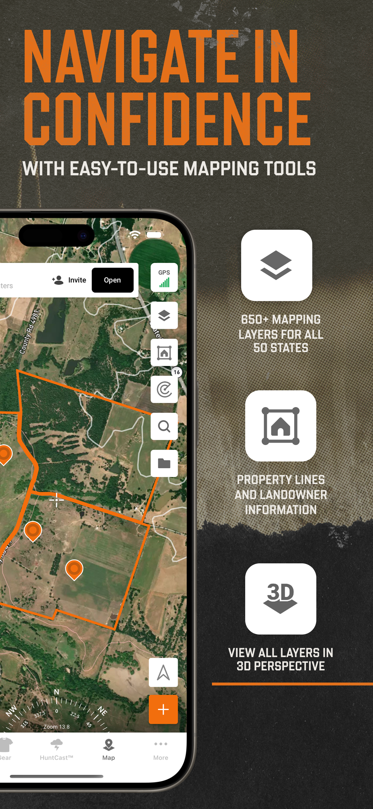
Screenshots


How Much Does HuntWise: A Better Hunting App Make?
Platform Performance
Rating Distribution
Top Countries
Rankings
Reviews (3)▼
As a land owner, all this proliferation of data to the masses has been a huge problem with people seeing what we have had work hard to purchase and maintain and then hound the land owners for hunting privileges. We (landowners) have worked years, ate beans and rice, drove old cars, don't go out to eat, work 60-70 hours a week to have a quiet peaceful place to hunt and live in peace. Leave us alone and stay off the land. It is for friends and family. NOT strangers with an App. If a stranger calls or asks to hunt it will always be NO. Do you go to my church? Are you a blood relative? No no no no. Also. The these maps are based on county tax maps (GIS data, im in real estate) there are notoriously inaccurate. If you are trusting these maps without knowing the surveyor boundaries you could end up prosecuted for trespassing, loose your guns, loose years of hunting rights and possibly end up in jail. Not to mention the fines and a criminal record. Talk to people you know personally, show your of good character, go help work the land and repair habitat and then maybe you will get hunting rights.
Love the app, use it to mark down everything I see. A couple of things that I have experienced that I hope can be improved: When you have very bad reception and are recording your path, the recorded path will erase entirely when you go somewhere and have no reception. I understand not being able to continue the recorded path at that point, but it would be VERY helpful if it would auto save the path that was being recorded up to that point, and also if it would have an option to automatically resume the path whenever you get back into an area with reception. Second, I wish that it would show your current elevation when you are creating a marker or recording a path. No need to continuously track elevation, but i would love to be able to see what elevation the path began and ended at, with occasional updates every 500 feet up or down, or something like that. At the very least, having the best guess at current elevation when pinning a marker would be awesome. Other than those two things, it works awesome and I will continue to use it and pay the membership during the seasons I use it often.
I use this app mainly for property lines and the mapping. Other apps are way more expensive a year for literally only one state worth of property lines. The 3D feature has to be the best thing about it, being able to look at a 3D map of the terrain in a hilly area really improves scouting. Only downfall is the map doesn’t show a lot of smaller creeks that are in the woods, but I can usually pull up google maps and it’ll show me if I’m really curious. I’ve never tried any of the weather stuff or go off of any of the “hunt predictions” so I can’t say anything about those. Truly if you want to know the weather check it on your phone and get out there in the woods regardless because it’s unpredictable. All in all tho it’s a very useful thing to have if you want to pay for the membership.
Version History (151)▼
Available In (102 Countries)▼
Supported Languages (1)▼
App Details▼
HuntWise provides the ultimate hunting advantage that optimizes your outdoor experience and increases your odds of filling your tag and your freezer e...
In-App Purchases (4)
| Name | Price | Type |
|---|---|---|
| Pro Subscription - Monthly | $19.99 | Monthly |
| Elite Subscription - Monthly | $39.99 | Monthly |
| Pro Subscription - Annual | $59.99 | Yearly |
| Elite Subscription - Annual | $119.99 | Yearly |
Similar Apps


