App Profile: Boating Caribbean&S.America

Android / Games / Puzzles
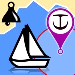
Boating Caribbean&S.America
Installs:
Rating:
3.73
Total Reviews:
15
Top Countries:
US, BR, FR
< $5k
/mo
< 5k
/mo
Reviews: What People Think About Boating Caribbean&S.America
SailinFamily
Rating: 5/5
We used this app for navigation throughout the Caribbean and LOVED IT. We downloaded the app and the charts while we had wifi and then never needed wifi or cell signal again for this app to work. Even in the most remote places the app followed us just like a full fledged chartplotter would. We also love the tracking feature. Easily track yoursel so you can follow your track back out of tight spots!
CrisFon
Rating: 1/5
This app was my main source for wind forecast and worked for years. However, recently weather (wind and tide) stopped working even though I have two subscriptions up to date. Have contacted support but it takes forever to get responses while live chat is never available. I ended up having to delete my app and download again in attempt to refresh those features but none came back and I lost my marks and tracks. I still have hope to get it back as I use it on my Garmins plotters in my boat.
Pw henderson
Rating: 1/5
I’m a pro boat captain. I originally paid the one time fee for this app. It’s not ok to renig on our deal and wipe my charts.
For those paying annually, you could find yourself at sea and your charts suddenly wiped from your device at expiration. Happened to me. This is a safety issue and is unethical.
I’ve since discovered there are other great chart apps.
About Boating Caribbean&S.America
THIS APP WILL BE DISCONTINUED!
> SEARCH this store for our “Boating Marine & Lakes” FREE app.
> Download it and get a 2-week trial of the subscription to check out the charts and features. Then subscribe.
Boating Marine & Lakes is a favorite among cruisers, anglers, sailors, and divers, with the same detailed charts and advanced features as on the best GPS plotters.
With Boating Marine & Lakes you will get:
>THE MOST DETAILED CHART LAYERS FOR OFFLINE USE - Nautical Chart, SonarChart™ and Community Edits. Plus, local information from the Garmin ActiveCaptain Community.
> DAILY CHART UPDATES, more than 2,000 every day!
> ADVANCED FEATURES like Dock-to-dock Autorouting, Advanced Map Options and more!
Search for “Boating Marine & Lakes” and discover more.
File size: 145909760
Launched countries: USAUCACNFRDEGBITJPKRRUARATBEBRBGCLCOCRHRCZDKDOECEGSVFIGRGTHKHUINIDIEILKZKEKWLBLTLUMOMGMYMXNLNZNOPKPAPEPHPLPTQAROSASGSKSIZAESLKSECHTWTHTNTRAEUYVEVNEELVNIPY
Minimum OS version: 9.0
Release Date: 1283151600000
Published by NAVIONICS S.R.L.
Website url:
Publisher country: Italy
Related Apps

ActiveCaptain®
3.9/5
4k reviews

iNavX: Marine Navigation
4.8/5
20k reviews

Dockwa
4.9/5
29k reviews

RayRemote
2.0/5
28 reviews
Anchor! drag alarm
4.4/5
274 reviews
Anchor Watch
3.1/5
15 reviews

PredictWind Race Tracker
0.0/5
0 reviews

Anchor Alarm with Late Set
4.7/5
375 reviews
SafeAnchor.Net Anchor Alarm
4.6/5
157 reviews

Anchor Zone Alarm
0.0/5
0 reviews